இலங்கையில் இயற்கை இடர்கள்
கடந்த அலகில் உலகின் இயற்கை இடர்களைப் பார்த்தோம். இலங்கையில் பெரும் நிலநடுக்கங்களோ எரிமலை இடர்களோ பெருமளவில் ஏற்படுவதில்லை; ஏனெனில் நாம் உறுதியான இந்தியத் தட்டின் (Indian Plate) நடுவில் இருக்கிறோம். ஆனால் (1) வெள்ளம், (2) நிலச்சரிவு, (3) வறட்சி, (4) சூறாவளி, (5) கடற்கரை அரிப்பு, (6) சுனாமி (2004), (7) மின்னல் தாக்குதல் ஆகியவை இலங்கைக்கு மிகவும் தொடர்புடையவை. இந்த அலகில் இலங்கைக்கு வரும் இடர்களின் பகிர்வு, காரணம், தாக்கம் ஆகியவற்றையும், Disaster Management Centre (DMC), DMA 2005, Sendai நிலையில் இலங்கையின் உத்தி (strategy) பற்றியும் அறிவோம்.
1. இலங்கையின் இயற்கை இடர்கள் — ஓர் கண்ணோட்டம்
இலங்கை உறுதியான கண்டத் தட்டின் (continental plate) நடுவில் இருப்பதால் குறிப்பிடத்தக்க நிலநடுக்கங்களோ எரிமலைகளோ இல்லை. ஆனால் tropical monsoonal climate + island geography + steep central highlands + dense coastal population + climate change vulnerability ஆகிய காரணிகள் இலங்கையைப் பல வகை இடர்களுக்கு (hazards) உட்படுத்துகின்றன. முக்கிய இடர்கள்:
- Floods — ஆண்டுதோறும் பெரும்பாலான மாவட்டங்கள் (~75-100%) ஒருமுறையாவது வெள்ளத்தால் பாதிக்கப்படுகின்றன.
- Landslides — central highlands wet zone.
- Droughts — dry zone, recurring.
- Cyclones — eastern coast, occasional.
- Coastal erosion — SW coast significantly.
- Tsunami — 2004 once-in-history but possibility persists.
- Lightning — Sri Lanka world's highest lightning casualties per capita.
- Sea level rise + erosion — climate change-driven.
- Forest fires — dry zone occasional.
- Industrial + chemical accidents — emerging.
2. வெள்ளம் (Floods) — அடிக்கடி ஏற்படும் இடர்
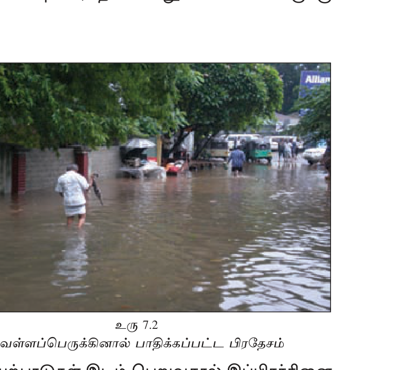
பெரிய ஆற்றுப் படுகைகளும் அடிக்கடி வெள்ளம் ஏற்படும் இடங்களும்
- Kelani Ganga — Colombo, Gampaha, Kegalle, Ratnapura. Wet zone monsoon flooding.
- Kalu Ganga — Ratnapura district frequent. May 2003, 2017, 2024 major events.
- Nilwala Ganga — Matara low-lying.
- Mahaweli — usually managed via dams; downstream Polonnaruwa/Trincomalee.
- Walawe Ganga — Hambantota, Ratnapura.
- Aruvi Aru (Malwathu Oya) — Anuradhapura.
- Eastern Province rivers — Maduru Oya, Gal Oya.
காரணம்
- Heavy monsoon rain — SW (May-Sep) flooded SW coast + central wet zone; NE (Oct-Feb) flooded eastern + dry zone.
- Inter-monsoon convectional thunderstorms Mar-Apr, Oct.
- Tropical depressions + cyclones from Bay of Bengal.
- Deforestation — reduced infiltration, increased runoff.
- Urbanization — paved surfaces, blocked drainage (Colombo flash floods).
- Sand mining + river bed alteration.
- Climate change — more intense rainfall events.
- Reservoir dam release — coordinated but contributes downstream.
இலங்கையின் பெரும் வெள்ள நிகழ்வுகள்
- 1957 — historic flood, Mahaweli basin.
- 2003 May — Ratnapura, Galle, Kalutara, Matara; 260+ dead.
- 2010-11 — Eastern Province NE monsoon; 1M+ displaced.
- 2014 — Northern + Eastern.
- 2016 May Cyclone Roanu — landslides + flooding; 100+ dead.
- 2017 May — SW monsoon; Kalu Ganga; 200+ dead; Bulathkohupitiya landslide.
- 2018-19 — multiple events.
- 2024 May-Jun — Eastern + central; flooding + landslides.
3. நிலச்சரிவு (Landslides)
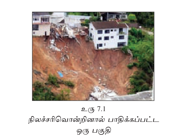
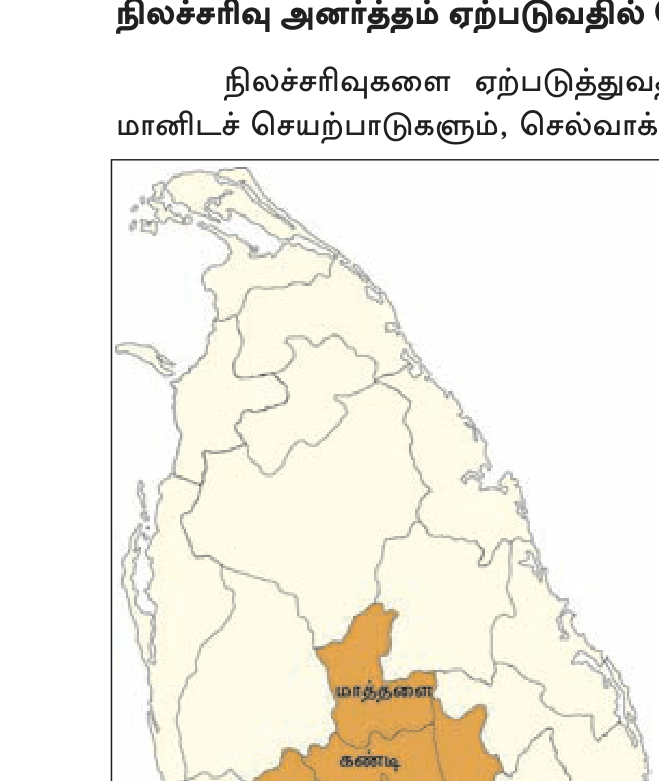
Vulnerable areas
Central highlands + foothills (wet zone). 10 முக்கிய மாவட்டங்கள் பின்வருமாறு: Nuwara Eliya, Kandy, Badulla, Ratnapura, Matale, Kegalle, Kalutara, Galle, Matara, Hambantota. Affected area ~20,000 km² (30% of SL land).
காரணங்களும் தூண்டுதலும் (Trigger)
- Steep slopes — Central highlands averaging 15-30°+.
- Heavy rainfall — 300+ mm in 24h commonly triggers.
- Weak rock + soil (regolith) — laterite, residual.
- Deforestation — tea/cardamom/vegetable cultivation removes root anchoring.
- Improper construction — slope cutting, road expansion (e.g. Badulla road expansion).
- Earthquakes — rare in SL but historical.
- Slope failure history — recurrence common.
இலங்கையின் பெரும் நிலச்சரிவுகள்
- 1957 Kandy — Helauda; 12 dead.
- 1986 Walapane — 122 dead.
- 1989 Padiyapelella — 36 dead.
- 2003 Kelani Valley — heavy rain trigger.
- 2014 Meeriyabedda (Koslanda, Badulla) — 38 dead; tea estate housing destroyed.
- 2016 Aranayake, Kegalle — 127 dead; deadliest in SL history.
- 2017 Bulathkohupitiya (Kegalle) — multiple landslides + floods; 200+ dead.
- 2024 May Bandarawela, Hatton — wet zone events.
NBRO Role
National Building Research Organisation (NBRO) — primary landslide research + monitoring + warning organisation. Hazard zonation maps, early warning, geotechnical advice.
4. வறட்சி (Droughts)
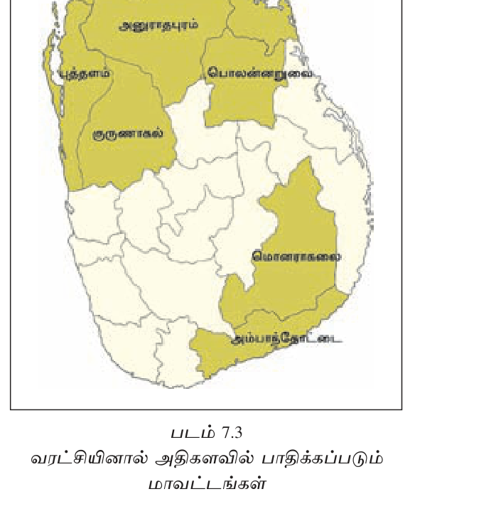
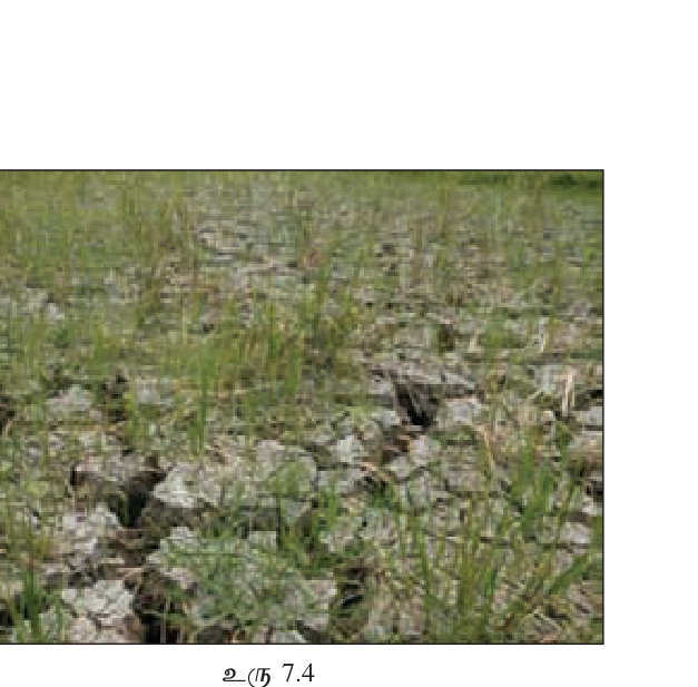
Vulnerable areas
Dry zone: NCP (Anuradhapura, Polonnaruwa, Kurunegala), Hambantota, Monaragala, Mannar, Vavuniya, Mullaitivu, Trincomalee. Annual rainfall <1250 mm; main rain via NE monsoon Oct-Feb only.
காரணம்
- NE monsoon failure — irregular Maha season rainfall.
- El Niño years — disrupted monsoon.
- SW monsoon rain shadow — central highlands block.
- Climate change — increasing variability.
- Forest loss — reduced moisture recycling.
- Over-abstraction — irrigation + drinking water demand.
- Tank network degradation — silting, encroachment.
இலங்கையின் முக்கிய வறட்சிகள்
- 1976-77, 1986-87, 1996-97, 2001-02, 2016-17, 2024 — recurring.
- 2016-17: 2M+ affected; agriculture losses Rs 30B+.
- 2017 Maha season failure followed by 2017 May floods — extreme rainfall variability.
பாதிப்புகள் (Impact)
- Paddy yield loss + food insecurity.
- Drinking water shortages.
- Hydropower generation drop → grid stress.
- Livestock + plantation impact.
- Chronic Kidney Disease (CKDu) link suspected — agro-chemical + fluoride water concentrations.
5. சூறாவளி (Cyclones)
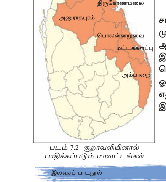
SL cyclone vulnerability
Bay of Bengal cyclones occasionally hit SL — particularly Eastern + Northern coasts. Less frequent + intense than Bangladesh/E India ones (SL on outer track of most systems). Seasons: Oct-Nov + Apr-May.
இலங்கையின் முக்கிய சூறாவளிகள்
- 1907 — Mannar.
- 1922 — north.
- 1964 December — Eastern Province; Batticaloa devastated; 100s dead.
- 1978 November Cyclone — Batticaloa + Trincomalee; 700+ dead; 1M displaced; heaviest known SL cyclone impact.
- 1992 Cyclone — Eastern Province.
- 2000 Cyclone — north.
- 2016 May Cyclone Roanu — flooding + landslides Western + Sabaragamuwa; 100+ dead.
- 2018 May Cyclone Sagar — outer effects.
- 2024 May Cyclone Remal — outer effects, heavy rain Eastern.
6. கடற்கரை அரிப்பும் புயல் அலையும் (Coastal Erosion, Storm Surge)
SL 1,340 km coastline + dense population (50%+ within 25km). Concerns:
- SW coast erosion — Beruwala, Bentota, Hikkaduwa, Galle — peak erosion during SW monsoon.
- Sand mining — beach + offshore sand removal destabilizes.
- Coral mining — coral lime cement industry past — left coast unprotected.
- Harbour breakwater impacts — Colombo, Hambantota ports modify currents.
- Sea level rise — climate change-driven; ~10 cm last 30 years.
- Cyclone storm surge — east coast.
- Coral bleaching — 2016, 2024 mass events — reefs less protective.
Coast Conservation Department (CCD) — manages 300m setback regulations + protection works (groynes, revetments). Mangrove restoration programs (Negombo, Madu Ganga).
7. சுனாமி (Tsunami) — 2004
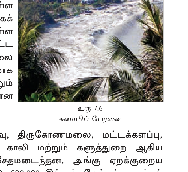
Detail covered in previous unit (G11 U6). SL highlights:
- Dec 26 2004 — Sumatra M9.1 ~2 hours later reached SL.
- ~35,000-40,000 dead; 500,000+ displaced.
- Peraliya train disaster — ~1,700 dead — deadliest single train disaster in history.
- Most affected: Eastern coast (Trincomalee, Batticaloa, Ampara), Southern coast (Hambantota, Matara, Galle), parts of NW (Negombo).
- Yala wildlife — most animals sensed and fled inland; remarkable behaviour.
- Aftermath: Disaster Management Act 2005 + DMC; IOTWS 2006; coastal building setbacks.
- Reconstruction — 5-7 years; international aid + diaspora.
- Memorials: Peraliya train, Hambantota statue.
- Future risk — Sumatran subduction zone still locked; another tsunami possibility persists.
8. மின்னல் (Lightning)
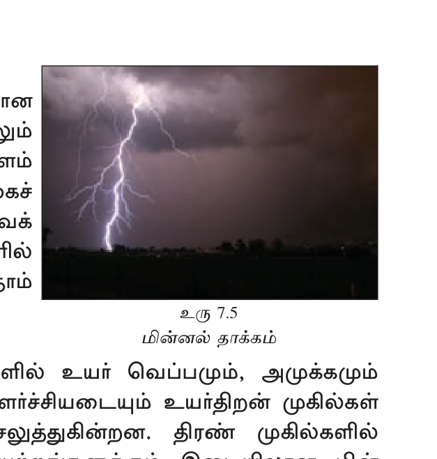
Surprising fact — SL has world's highest lightning casualties per capita. ~50+ deaths/year. Why?
- Tropical convectional storms — high CAPE + humidity.
- Inter-monsoon March-April + October peak.
- Rural exposure — paddy fields during planting/harvest.
- Construction labour outdoor.
- Tree shelter myth — many die under trees (NOT safe).
- Limited building grounding.
Department of Meteorology lightning warnings. Public education on safety. Lightning rods on tall buildings.
9. பேரிடர் மேலாண்மை (Disaster Management): இலங்கையின் கட்டமைப்பு
Disaster Management Act 2005
Post-2004 tsunami legislation — established statutory framework:
- National Council for Disaster Management (NCDM) — chaired by President; PM + ministers.
- Disaster Management Centre (DMC) — operational arm under MOD/PMD; coordinates response.
- District + Divisional Disaster Management Committees.
- National + Subnational DRM Plans.
Key Institutions
- DMC — coordination + early warning + response.
- NBRO — landslides.
- Department of Meteorology — weather warnings.
- Department of Irrigation — floods + tank operation.
- Coast Conservation Department (CCD) — coastal management.
- CEA — environmental + post-disaster pollution.
- NDMC + DDMC + DvDMC at multiple admin levels.
- Tri-Services (Army/Navy/Air Force) — emergency response.
- Sri Lanka Red Cross + local NGOs.
- UN OCHA + UNDP + international partners.
Sendai Framework alignment
SL is signatory to Sendai 2015-30. National DRM Plan 2018-30 aligns with Sendai priorities. Mainstreaming DRR into development planning (\"Build Back Better\" + climate adaptation).
Insurance
- National Natural Disaster Insurance Scheme (NNDIS) — Sri Lanka Insurance — covers households up to Rs 2.5M; SMEs up to Rs 2M.
- Operated post-2016 floods/landslides; government-funded premium for poor.
- SL = stable plate interior — no major quakes/volcanoes. But cyclones, floods, landslides, droughts, tsunami (2004), lightning common.
- Flood rivers: Kelani, Kalu (Ratnapura frequent), Nilwala, Mahaweli, Walawe, Aruvi Aru.
- Landslide districts (10): Nuwara Eliya, Kandy, Badulla, Ratnapura, Matale, Kegalle, Kalutara, Galle, Matara, Hambantota.
- Major landslides: 1986 Walapane (122); 2014 Meeriyabedda (38); 2016 Aranayake (127 — deadliest).
- NBRO = landslide research + warning.
- Drought zone: NCP + Hambantota + Monaragala + Mannar + Mullaitivu. Annual rain <1250 mm.
- Major cyclones SL: 1964 Eastern; 1978 Nov (700+ dead, deadliest); 2016 Roanu.
- SL on cyclone track — outer track usually; Eastern + Northern provinces most vulnerable.
- 2004 Tsunami: ~35-40K dead; Peraliya train ~1,700 (deadliest train ever).
- SL world\'s highest lightning casualties per capita — ~50+ deaths/year.
- Disaster Management Act 2005 + DMC established post-tsunami.
- NCDM (President-chaired) + DMC operational.
- NNDIS insurance scheme.
- SL plate-interior, NOT plate boundary — no major earthquakes/volcanoes. Tsunami can come from elsewhere.
- "Cyclone" not "typhoon" — SL = Bay of Bengal cyclones (Indian Ocean naming).
- Lightning = number-one preventable death — SL world-high per capita.
- Landslides 10 districts (not just Kandy + Nuwara Eliya).
- Tsunami affected MORE than just SL Eastern coast — entire coast + tourist areas south + west.
- DMC = operational; NCDM = policy.
- "Sendai Framework" = UN framework SL signed; not SL-only.
- 2016 Aranayake = single deadliest landslide (127 dead, not Walapane 122).
- Dry zone tank network = adaptation strategy, ancient infrastructure.
✅ விரைவுச் சோதனை
முக்கியக் கருத்துக்களை உறுதிப்படுத்துங்கள். தவறான விடைகள் உங்கள் தவறுக் குறிப்பேட்டில் சேமிக்கப்படும்.
🖊 கட்டுரை வினாக்கள் (பகுதி II)
பரீட்சை வடிவில் கட்டமைப்பு வினாக்கள். முதலில் நீங்களே எழுதுங்கள்; பின்னர் மாதிரி விடையைத் திறந்து சரிபாருங்கள்.
விடைத் திட்டம் — சேர்க்க வேண்டிய புள்ளிகள்:
- SL stable plate interior; no major quakes/volcanoes
- Floods: Kalu+Kelani+Nilwala basins; 2003/2017/2024
- Landslides: 10 districts central wet zone; 2016 Aranayake 127 dead
- Droughts: dry zone NCP+Hambantota; 2016-17 widespread
- Cyclones: Eastern province; 1978 deadliest 700+
- Tsunami: 2004 35K+ dead Peraliya 1700
- Lightning: world's highest casualties per capita 50+/yr
**(1) Floods (வெள்ளம்) — SL\'s most common hazard.**
- **Main flood basins:** Kelani (Colombo + Gampaha + Kegalle); Kalu (Ratnapura — most flood-frequent in SL); Nilwala (Matara); Mahaweli downstream (Polonnaruwa/Trincomalee); Walawe (Hambantota); Aruvi Aru (Anuradhapura); Eastern Province rivers (Maduru Oya, Gal Oya).
- **Causes:** Heavy monsoon rain (SW May-Sep flooded SW wet zone; NE Oct-Feb flooded dry/eastern); inter-monsoon convectional storms (Mar-Apr, Oct); tropical depressions from Bay of Bengal; deforestation; urbanization-driven flash floods (Colombo); sand mining + climate change-driven intense rainfall.
- **Major events:** 1957 historic Mahaweli flood; 2003 May (260+ dead, Ratnapura/Galle/Kalutara); 2010-11 Eastern (1M+ displaced); 2014 Northern + Eastern; 2016 May Cyclone Roanu (100+ dead); 2017 May SW monsoon (200+ dead, Bulathkohupitiya landslide); 2024 May-Jun multi-region.
**(2) Landslides (நிலச்சரிவு) — Central highlands focus.**
- **Vulnerable: 10 districts** — Nuwara Eliya, Kandy, Badulla, Ratnapura, Matale, Kegalle, Kalutara, Galle, Matara, Hambantota. Affected area ~20,000 km² (30% land).
- **Causes:** Steep slopes (15-30°+); heavy rain (300+ mm/24h triggers); weak regolith (laterite); deforestation (tea/cardamom/vegetable expansion); slope cutting (road construction); historical recurrence.
- **Major events:** 1957 Helauda (12 dead); **1986 Walapane (122)** — major early; 1989 Padiyapelella (36); 2003 Kelani valley; **2014 Meeriyabedda (Koslanda, Badulla) — 38 dead, tea estate housing destroyed**; **2016 Aranayake (Kegalle) — 127 dead** (deadliest single SL landslide); **2017 Bulathkohupitiya (Kegalle) — multi-landslides + floods 200+ dead**.
- **NBRO** (National Building Research Organisation) is primary research + warning agency.
**(3) Droughts (வறட்சி) — Dry zone recurring issue.**
- **Vulnerable:** Dry zone — NCP (Anuradhapura, Polonnaruwa, Kurunegala), Hambantota, Monaragala, Mannar, Vavuniya, Mullaitivu, Trincomalee. Annual rainfall <1250 mm; depend on NE monsoon Oct-Feb.
- **Causes:** NE monsoon failure; El Niño years; SW monsoon rain shadow; climate change variability; forest loss; over-abstraction; tank network degradation.
- **Recurring years:** 1976-77, 1986-87, 1996-97, 2001-02, **2016-17 (2M+ affected, Rs 30B losses)**, 2024.
- **Impact:** paddy yield loss; drinking water shortage; hydropower drop; livestock losses; CKDu suspected agro-chemical/fluoride water link.
**(4) Cyclones (சூறாவளி) — Eastern + Northern provinces.**
- SL on outer Bay of Bengal cyclone track. Seasons: Oct-Nov + Apr-May.
- **Major events:** 1907 Mannar; 1922 north; **1964 Dec — Batticaloa devastated**; **1978 Nov — Batticaloa/Trincomalee 700+ dead, 1M displaced (deadliest SL cyclone)**; 1992 Eastern; 2000 north; 2016 May Cyclone Roanu (flooding + landslides 100+ dead); 2018 Sagar outer; 2024 Remal outer.
**(5) Tsunami (சுனாமி) — 2004 once-in-history.**
- Dec 26 2004 M9.1 Sumatra epicenter → reached SL ~2 hours later. **~35,000-40,000 dead, 500,000+ displaced**. Eastern + Southern coasts worst hit; SW also affected (Galle, Hikkaduwa). **Peraliya train (Telwatta near Hikkaduwa) — ~1,700 dead — deadliest single train disaster in history**. Yala wildlife sensed and fled inland.
- Future risk: Sumatran subduction zone still locked; another event possible.
**(6) Lightning (மின்னல்) — SL world\'s highest casualties per capita.**
- ~50+ deaths/year — highest globally per capita.
- **Causes:** tropical convective thunderstorms (high CAPE + humidity); inter-monsoon peak (Mar-Apr, Oct); rural exposure (paddy fields); tree-shelter myth (many die under trees); limited grounding in rural structures.
**(7) Other:** Coastal erosion (SW coast Beruwala-Galle); coral bleaching (2016, 2024 mass events); occasional forest fires (dry zone); industrial accidents.
SL is multi-hazard prone — preparedness + mitigation crucial. DMC + NBRO + Met Dept + CCD + tri-services coordinate. Sendai 2015-30 framework + National DRM Plan 2018-30 guide strategy.
விடைத் திட்டம் — சேர்க்க வேண்டிய புள்ளிகள்:
- Dec 26 2004 M9.1 Sumatra → SL ~2 hrs
- 35K dead; 500K+ displaced
- Eastern + Southern + SW coasts worst
- Peraliya train ~1,700 dead — deadliest train disaster
- Yala animals fled
- Aftermath: DMA 2005, DMC, NBRO expanded
- IOTWS 2006 established
- Coastal setbacks 100-300m
- International aid + reconstruction 5-7 years
- Memorials Peraliya + Hambantota
**SL Impact Detail:**
**Death toll:** ~35,000-40,000 dead (precise count never possible — many fishing community + tourists). **500,000+ displaced**. **800,000+ requiring relief.**
**Geographic spread:**
- **Eastern Province** (Trincomalee, Batticaloa, Ampara) — worst hit. ~1/2 of deaths. Fishing villages of muslim + Tamil communities devastated.
- **Southern Province** (Hambantota, Matara, Galle) — second worst. Tourist beaches in Christmas-New Year peak season. Tangalle, Mirissa, Weligama, Unawatuna.
- **SW coast** (Beruwala, Bentota, Hikkaduwa) — tourist resorts ravaged.
- **NW coast** (Negombo, Marawila) — moderate damage.
- **Northern** (Mullaitivu, Jaffna) — affected but LTTE-controlled area; limited information; significant fisher community losses.
**Peraliya Train Disaster (Queen of the Sea, "Samudradevi"):**
The coastal Galle Road train, packed with ~1,500-2,000 passengers, was overrun by the second wave near Telwatta (close to Hikkaduwa). Two waves bashed the train. **~1,700 dead** — single deadliest train disaster in world history. Memorial erected at Peraliya.
**Yala National Park Animals — Remarkable Story:**
Reports of elephants, monkeys, deer, leopards moving inland or to higher ground BEFORE the wave hit. Few wildlife casualties despite human deaths at Yala camps. Behavioural science theory: animals perceive infrasonic vibrations + sense atmospheric pressure changes humans cannot.
**Why So Devastating?**
1. **No Indian Ocean tsunami warning system** existed.
2. **No public awareness** — "tsunami" word unfamiliar even in Tamil/Sinhala media.
3. **2-hour warning window unused** — even though Indonesia knew quake within minutes.
4. **Coastal density** — fishing villages + tourism + dense.
5. **First wave smaller in some places** — people went to see exposed seabed; second wave killed.
6. **Boxing Day weekend** — relaxed beachgoers; tourists abundant.
7. **No coastal building setbacks** — homes built at high-tide line.
8. **Civil war** — northeast had no warning infrastructure.
9. **Geographic exposure** — east coast directly facing Sumatra.
**Immediate Response (Dec 26 - Jan 2005):**
- Tri-Services (Army/Navy/Air Force) mobilized for rescue + relief.
- Sri Lanka Red Cross + international NGOs (MSF, UNHCR, IFRC, ICRC).
- Sri Lanka government emergency declaration.
- International aid: **largest humanitarian operation in history at the time**. Pledged ~$13 billion globally; SL received ~$2-3 billion.
- USA, India, EU, Japan, China, Middle East — bilateral aid.
- LTTE-government truce brief — collaboration in northeast briefly possible.
- Mass identification + burial challenge; 7,500+ buried in mass graves.
- IDP welfare centres established in schools + temples + churches.
**Medium-term Recovery (2005-08):**
- Housing reconstruction — 100,000+ houses rebuilt by various agencies.
- Tourism infrastructure rebuilt (faster than expected).
- Fishing fleet replaced (with international aid).
- Schools, hospitals, police stations rebuilt.
- Roads, railways, power infrastructure restored.
- **5-7 year recovery timeline.**
**Legal + Institutional Reform:**
1. **Sri Lanka Disaster Management Act No. 13 of 2005** — established statutory framework.
2. **National Council for Disaster Management (NCDM)** — chaired by President; PM + ministers + DGs.
3. **Disaster Management Centre (DMC)** — operational arm under PMD/MOD; coordinates response.
4. **NBRO expansion** — landslide research + zonation maps + early warning.
5. **District + Divisional Disaster Management Committees** — decentralized.
6. **National Disaster Risk Management Policy.**
**International System Reform — Indian Ocean Tsunami Warning System (IOTWS):**
- Established 2005-06 under **UNESCO IOC** (Intergovernmental Oceanographic Commission).
- **Regional Tsunami Service Providers:** Australia, India, Indonesia (Tsunami Warning Centres).
- **DART buoys** (Deep-ocean Assessment & Reporting of Tsunamis) deployed across Indian Ocean.
- **Coastal sirens** + **SMS alerts** + **media broadcast** protocols.
- **Tsunami evacuation routes signposted** along SL coast.
- **Public education + drills** annually.
**Coastal Management Reform:**
- **Coast Conservation Department (CCD)** strengthened.
- **100-300m coastal setback** for new construction (depending on geomorphology).
- **"Build Back Better"** principle — Hyogo Framework 2005 (later Sendai 2015) adopted.
- **Mangrove + coral restoration** — natural barriers.
**Memorials + Cultural Memory:**
- **Peraliya** — railway carriage retained, memorial statue. Tsunami Honganji Memorial.
- **Hambantota** — large public sculpture.
- **2004 Tsunami Museum** — Hikkaduwa.
- **Annual remembrance day Dec 26.**
- **"Wave of Destruction, Wave of Hope"** documentaries.
**Critical Reflections:**
- **Aid effectiveness** — some money lost to corruption + duplication.
- **Coastal land grabs** — some displaced fishing communities replaced by tourism developments. "Coastal poor displaced by reconstruction."
- **Climate change context** — sea level rise + cyclone intensification make coastal risk persistent.
- **Equity:** northeast Tamils + Muslim communities historically marginalized; some assistance discriminatory.
- **Resilience built but vigilance must persist** — Sumatran zone still locked.
2004 changed SL forever — institutional, infrastructural, psychological. It also demonstrated international solidarity at unprecedented scale + accelerated global disaster risk reduction architecture.
விடைத் திட்டம் — சேர்க்க வேண்டிய புள்ளிகள்:
- DM Act 2005 post-tsunami
- NCDM (President-chaired)
- DMC operational
- NBRO landslides, Met Dept weather, CCD coastal
- District + Divisional committees
- Sendai 2015-30 alignment
- National DRM Plan 2018-30
- NNDIS insurance
- Build Back Better principle
**Legal Foundation:**
- **Sri Lanka Disaster Management Act No. 13 of 2005** — passed January 2005, just weeks after tsunami. Established statutory disaster management architecture for first time.
- **National Disaster Management Policy** subsequent.
- **Disaster Management Centre Regulations**.
**Institutional Hierarchy:**
**(1) National Council for Disaster Management (NCDM):**
- **Highest policy-making body.**
- Chaired by **President of Sri Lanka**.
- Members: Prime Minister, key Cabinet ministers (Defence, Environment, Health, Public Administration, Provincial Councils), Chief Ministers, opposition leaders.
- Sets policy + strategic direction.
- Activated during major events.
**(2) Disaster Management Centre (DMC):**
- **Operational arm under Ministry of Defence/PMD.**
- Director-General + technical/administrative staff.
- **Functions:** Early warning + alerts; coordination across agencies; emergency response; preparedness planning; risk assessment; relief management; recovery oversight; training + drills; public awareness.
- 24/7 Emergency Operations Centre.
- Maintains national disaster database + hazard maps.
**(3) Specialized Technical Agencies:**
- **NBRO** (National Building Research Organisation) — landslides research, hazard zonation, early warning, geotechnical advice. Pioneer SL agency for slopes.
- **Department of Meteorology** — weather forecasts, cyclone warnings, drought monitoring, lightning information.
- **Department of Irrigation** — flood management, tank operation.
- **Coast Conservation Department (CCD)** — coastal protection, setbacks, beach management.
- **Central Environmental Authority (CEA)** — environmental + post-disaster pollution.
- **NARA** — coastal + marine hazards.
- **Geological Survey & Mines Bureau (GSMB)** — seismology, mineral hazards.
**(4) Subnational Structure:**
- **District Disaster Management Committee (DDMC)** — each of 25 districts. Chaired by District Secretary.
- **Divisional Disaster Management Committee (DvDMC)** — each Divisional Secretariat.
- **GN Disaster Management** — Grama Niladhari grassroots level.
- **Provincial Disaster Management Coordinators**.
**(5) Emergency Response Forces:**
- **Sri Lanka Army** — main rescue + relief; engineering battalions.
- **Sri Lanka Navy** — coastal search + rescue, evacuation.
- **Sri Lanka Air Force** — air rescue, supply drops.
- **Sri Lanka Police** — Special Task Force; traffic + crowd management.
- **Tri-Services Mobilisation** in major disasters.
**(6) Civil Society + International:**
- **Sri Lanka Red Cross Society** — Auxiliary to government.
- **IFRC + ICRC** — partnership.
- **NGOs:** Save the Children, Oxfam, World Vision, MSF, ADRA, etc.
- **UN agencies:** UNDP, UNICEF, WFP, FAO, UNHCR, WHO, OCHA.
- **IOM** (International Org. for Migration).
- **Bilateral partners:** Japan (JICA), USAID, AusAID, EU.
**Sendai Framework Alignment (2015-2030):**
SL is signatory. **Four priorities aligned in national framework:**
1. **Understanding disaster risk** — hazard mapping (NBRO + DMC + others), vulnerability assessment, climate projections.
2. **Strengthening disaster risk governance** — DMC strengthening, sub-national capacity, multi-stakeholder.
3. **Investing in disaster risk reduction for resilience** — infrastructure (cyclone shelters, flood walls, slope stabilization), ecosystem-based approaches (mangroves, watersheds), social protection.
4. **Enhancing disaster preparedness for effective response** — early warning systems, evacuation plans, stockpiles, drills.
**Seven global targets:** SL contributing to all (death + affected populations reduction, economic loss reduction, infrastructure damage, DRM strategies, international cooperation, EWS coverage).
**National DRM Plan 2018-2030:**
- Aligned with Sendai + SDGs + Paris Agreement.
- Multi-hazard, multi-sectoral approach.
- Climate change adaptation mainstreamed.
- Build Back Better (BBB) principle.
- Community-based DRR (CBDRR).
- Gender + inclusion sensitive.
- ICT-enabled (apps, social media alerts).
**Early Warning Systems:**
- **Tsunami:** IOTWS + DART + sirens + SMS.
- **Cyclone:** Met Dept + IMD India coordination + media.
- **Flood:** Irrigation Dept + Met + DMC.
- **Landslide:** NBRO + DMC + community wardens.
- **Drought:** Met + Agriculture monitoring.
- **Lightning:** Met Dept alerts.
**Insurance — NNDIS (National Natural Disaster Insurance Scheme):**
- Launched **2016** after floods/landslides exposed lack of household insurance.
- **Sri Lanka Insurance Corporation** administers.
- Government-funded premium for poor households.
- **Household coverage up to Rs 2.5 million; SMEs up to Rs 2 million.**
- Triggered by floods, landslides, cyclones, droughts, lightning, fires.
- Aim: rapid post-disaster recovery without long government bureaucracy.
**Challenges:**
1. **Underinvestment** — DRM budget often considered "luxury" pre-disaster.
2. **Coordination gaps** — multiple agencies, jurisdictional friction.
3. **Climate change** — accelerating hazard frequency + intensity.
4. **Information dissemination** — last-mile communication to rural communities.
5. **Equity** — northeast historically less-served.
6. **Urban flooding** — Colombo Megapolis vulnerability.
7. **Capacity building** — local-level DRM volunteers + officials need continuous training.
8. **2022 economic crisis** — DRM resources stretched.
**Future Direction:**
- AI + GIS for hazard prediction.
- Community-based DRR scaling.
- Climate-resilient infrastructure investment.
- Insurance penetration deeper rural.
- Mainstreaming DRR in all development planning.
- Regional cooperation (SAARC, BIMSTEC, IORA).
🔥 மீட்டல் மையம்
பரீட்சைக்கு முன் இறுதி ஒரு நிமிடம் — மறக்கக்கூடாதவை மட்டும்.
- <b>SL = stable plate interior:</b> no major earthquakes/volcanoes. Subject to floods, landslides, droughts, cyclones, tsunami (2004), lightning, coastal erosion.
- <b>Floods:</b> Kelani, <b>Kalu (Ratnapura most frequent)</b>, Nilwala, Mahaweli, Walawe. Causes: monsoons + deforestation + urban.
- <b>Landslides:</b> 10 districts (Nuwara Eliya, Kandy, Badulla, Ratnapura, Matale, Kegalle, Kalutara, Galle, Matara, Hambantota). ~30% of land vulnerable.
- <b>Deadliest landslide:</b> <b>2016 Aranayake (Kegalle) — 127 dead</b>. Others: 1986 Walapane 122; 2014 Meeriyabedda 38.
- <b>NBRO</b> = landslide research + warning.
- <b>Droughts:</b> Dry zone NCP + Hambantota + Monaragala. <b>2016-17 major</b> (2M+ affected).
- <b>Cyclones:</b> Eastern + Northern. <b>1978 deadliest 700+ dead, 1M displaced</b>. 1964, 2016 Roanu, 2024 Remal.
- <b>Tsunami 2004:</b> M9.1 Sumatra → SL ~35K+ dead. <b>Peraliya train ~1,700 dead — deadliest train disaster</b>.
- <b>Lightning:</b> SL <b>world's highest casualties per capita</b> — ~50+ deaths/yr.
- <b>DM Act 2005</b> post-tsunami. NCDM (President-chaired). DMC operational.
- <b>Sendai Framework 2015-30</b> + National DRM Plan 2018-30.
- <b>NNDIS</b> = National Natural Disaster Insurance Scheme (SLIC).
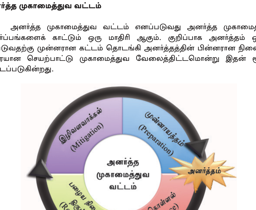
- <b>Cycle:</b> Mitigation → Preparedness → Response → Recovery.
அலகின் முதுகெலும்பு — கருத்துக்களும் தொடர்புகளும்.
- <b>Major flood events:</b> 1957 Mahaweli; 2003 May (260+ dead — Ratnapura/Galle/Kalutara); 2010-11 Eastern (1M+ displaced); 2014 N+E; 2016 May Roanu (100+); 2017 May (200+ Bulathkohupitiya); 2024 multi-region.
- <b>Landslide chronology:</b> 1957 Helauda (12); 1986 Walapane (122); 1989 Padiyapelella (36); 2003 Kelani valley; 2014 Meeriyabedda (38 — Indian-origin estate housing); 2016 Aranayake (127 deadliest); 2017 Bulathkohupitiya (200+ multi-event); 2024 Bandarawela/Hatton.
- <b>Landslide causes:</b> steep slopes 15-30°+, heavy rain 300+mm/24h trigger, weak regolith (laterite), deforestation (tea/vegetable), slope cutting (roads), historical recurrence.
- <b>Drought details:</b> Dry zone <1250 mm; depends on NE monsoon Oct-Feb. Recurring years: 1976-77, 1986-87, 1996-97, 2001-02, 2016-17 (2M affected, Rs 30B losses), 2024.
- <b>Drought impacts:</b> Paddy yield loss; food insecurity; drinking water; hydropower drop; CKDu link (agro-chemical + fluoride water hypothesis in NCP/Uva).
- <b>Cyclone history:</b> 1907 Mannar; 1922 north; 1964 Dec Batticaloa; 1978 Nov Batticaloa+Trincomalee 700+ dead 1M displaced (deadliest); 1992 Eastern; 2000 north; 2016 Roanu (Sabaragamuwa+Western); 2018 Sagar; 2024 Remal outer.
- <b>Tsunami 2004 SL detail:</b> Worst hit Eastern Province (Trincomalee/Batticaloa/Ampara), Southern (Hambantota/Matara/Galle), SW (Beruwala/Hikkaduwa). Peraliya \"Queen of Sea\" train ~1,700 dead Telwatta. Yala wildlife mostly survived (fled inland). 800K displaced into camps.
- <b>2004 aftermath:</b> DMA 2005 + DMC; NBRO expanded; IOTWS 2006; CCD coastal setbacks 100-300m; \"Build Back Better\"; mangrove restoration; ~$2-3B aid; 5-7yr recovery.
- <b>Coastal erosion:</b> SW coast (Beruwala-Galle) worst — SW monsoon waves + sand mining + coral mining + harbour breakwaters. CCD setbacks + groynes + revetments. Mangrove restoration.
- <b>Lightning detail:</b> Tropical convective storms + high CAPE + humidity + inter-monsoon Mar-Apr+Oct peak + rural paddy field exposure + tree-shelter myth. Met Dept warnings; public education.
- <b>DMC + institutions:</b> NCDM (President-chaired policy); DMC operational coordination under MOD; NBRO landslides; Met Dept weather; Irrigation Dept floods; CCD coastal; CEA env; NARA marine; GSMB seismic; Tri-Services emergency; SL Red Cross + NGOs + UN.
- <b>Sub-national:</b> 25 District Disaster Management Committees + Divisional + GN level grassroots.
- <b>Sendai 4 priorities applied to SL:</b> (1) Understanding risk — NBRO maps + climate projections. (2) Strengthening governance — DMC + sub-national. (3) Investing in resilience — infrastructure + ecosystems + social protection. (4) Enhancing preparedness — EWS + evacuation + drills.
- <b>NNDIS detail:</b> Launched 2016 post-flood/landslide gaps. SLIC administers. Household Rs 2.5M + SME Rs 2M coverage. Government premium for poor. Triggered by floods/landslides/cyclones/droughts/lightning/fires.
பரீட்சைக்கு முந்தின இரவு முழு அலகையும் ஓட்டிப் பார்.
- <b>Quick numbers:</b> SL hazards — Aranayake 2016 (127 deadliest landslide); 1978 cyclone (700+ dead); 2004 tsunami (35K dead); Peraliya train (1700); lightning (50+/yr — world's highest per capita).
- <b>Year-event pairs:</b> 1964 Dec Batticaloa cyclone; 1978 Nov cyclone deadliest; 1986 Walapane landslide 122; 2003 May floods 260+; 2004 Dec 26 tsunami; 2014 Meeriyabedda landslide; 2016 Aranayake + Roanu; 2017 Bulathkohupitiya; 2024 Remal + multi.
- <b>10 landslide districts memorize:</b> Nuwara Eliya, Kandy, Badulla, Ratnapura, Matale, Kegalle, Kalutara, Galle, Matara, Hambantota.
- <b>எளிதில் தவறும்:</b> (1) SL plate interior — no quakes/volcanoes; tsunami came from elsewhere. (2) "Cyclone" not "typhoon" (Indian Ocean naming). (3) DMC=operational; NCDM=policy. (4) NBRO=landslide. (5) Aranayake 2016 (not Walapane 1986) deadliest single landslide. (6) Lightning world's highest casualties per capita — true SL fact.
- <b>கட்டுரைக்குத் தயார்:</b> (1) Multiple hazards overview. (2) 2004 tsunami SL impact + response + reform. (3) DM framework: Act 2005 + NCDM + DMC + Sendai alignment.
- <b>Future challenges:</b> Climate change intensifies (more cyclones, floods, droughts, sea level). Coastal vulnerability rising. Aging infrastructure. DRM budget constraints post-2022 crisis. Equity in north-east.
- <b>Key institutions to remember:</b> DMC (operational coordination), NBRO (landslides), Met Dept (weather), Irrigation Dept (floods), CCD (coastal), CEA (pollution), NARA (marine), GSMB (seismic). Tri-Services emergency response.
- <b>Build Back Better principle</b> = global Hyogo 2005 → Sendai 2015; SL adopted post-tsunami.