இலங்கையின் இயற்கை வளங்கள்
இலங்கை பரப்பளவில் சிறிய தீவாகும். ஆனால் நீர், காடு, மண், கனியம், கடல், சக்தி ஆகியவற்றை நோக்கும்போது அது ஒரு வளக் களஞ்சியமாகத் திகழ்கிறது. இதற்குக் காரணம், பருவக் காற்றுகள் கொண்டுவரும் மழை, பண்டைய சிங்கள மன்னர்கள் கட்டிய 4000+ குளங்கள், மலையோரப் பெருங்காடுகள், பழைமையான புவியியல் அமைப்பால் உருவான கிராப்பைட், இரத்தினக் கற்கள், கடற்கரையிலுள்ள கனிய மணல் (mineral sands), கடலிலுள்ள 517,000 km² EEZ என்பனவேயாகும். இவ்வலகில் இலங்கையின் (1) நீர் வளம், (2) காடு, (3) மண், (4) கனியங்கள் (கிராப்பைட், இரத்தினக் கற்கள், கனிய மணல்), (5) கடல் வளம் (maritime resources), (6) சக்தி ஆகியவற்றை அறிவோம். கடந்த அலகில் உலக வளங்களைப் பார்த்தோம்; இப்போது அவற்றை இலங்கைக்குப் பொருத்திப் பார்ப்போம்.
1. இலங்கை வளம் — ஏன் சிறப்பானது?
21 மில்லியன் மக்கள் வாழும் இலங்கை (65,610 km² நிலம்), ஓரலகுப் பரப்பில் எவ்வளவு வளம் உள்ளது என்று நோக்கும்போது, மிகப் பெரிய ஆசிய நாடுகளுக்கும் ஈடாக நிற்கக்கூடியது. இதற்கான காரணங்கள்:
- இரு பருவக் காற்றுகள் (SW மற்றும் NE monsoons): இதனால் ஆண்டு முழுவதும் மழை கிடைக்கிறது.
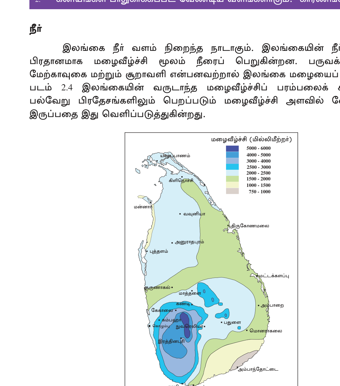
- மலை அமைப்பு: மத்திய மலைப்பகுதியில் மழை அதிகம்; தாழ்நிலங்களிலும் வரண்ட வலயத்திலும் மழையின் அளவு வேறுபடுகிறது.
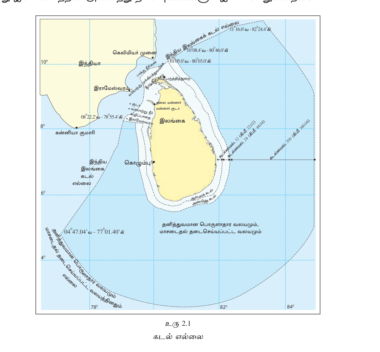
- பெரிய EEZ: நாட்டின் நிலப்பரப்பை விட 7 மடங்கு கடற்பகுதி உள்ளது.
- பழைமையான புவியியல் அமைப்பு: இதனால் கிராப்பைட்டும் இரத்தினக் கற்களும் உருவாகின.
- கடற்கரை: கனிய மணல் நிறைந்த (mineral sands) கடற்கரைகள் உள்ளன.
2. நீர் வளம் — இலங்கையின் உயிர்த் தண்ணீர்
மழையே இலங்கையின் முதன்மை நீர் மூலமாகும். ஆண்டு மழை சராசரி ~1860 mm; இது உலக சராசரியை விடப் பல மடங்கு அதிகம். ஆனால் இது எல்லா இடங்களிலும் சமமாகப் பகிரப்படவில்லை. மலையோரத்தில் (Nuwara Eliya, Watawala) 5000+ mm; வரண்ட வலயத்தில் (Anuradhapura, Hambantota) <1250 mm. மழை இரு பருவக் காற்றுகள் வழியாகக் கிடைக்கிறது:
- SW Monsoon (Yala), மே-செப்.: முக்கியமாகத் தென்மேற்குக் கடற்கரைக்கும் மலையோரத்துக்கும் மழை தருகிறது.
- NE Monsoon (Maha), அக்.-பிப்.: வடகிழக்குப் பகுதிக்கும் வரண்ட வலயத்துக்கும் மழை தருகிறது.
- பருவமாற்றக் காலங்கள் (Inter-monsoon) (மார்.-ஏப், அக்.): இக்காலங்களில் மேலெழுச்சி மழை (convectional rain) கிடைக்கிறது.
ஆறுகள் (Rivers)
இலங்கையில் 103 ஆறுகள் உள்ளன. அவை மத்திய மலைப்பகுதியிலிருந்து கடலை நோக்கி ஆரை வடிவில் (radial pattern) பாய்கின்றன. முக்கிய ஆறுகள்: Mahaweli (335 km, மிக நீளமானது), Kelani, Walawe, Kalu, Aruvi Aru (Malwathu Oya), Yan Oya, Mahaweli Ganga, Deduru Oya, Maha Oya. ஆறுகள் நீர்ப்பாசனம், நீர்மின்சாரம், குடிநீர், போக்குவரத்து ஆகியவற்றுக்குப் பயன்படுகின்றன.
பழம் தடாக நாகரிகம் (Ancient Tank Civilization)
இலங்கையின் நீர்ப்பாசன மரபு 3000+ ஆண்டுகள் பழைமையானது. அனுராதபுரம், பொலன்னறுவை ஆகிய இடங்களில் ஆட்சி செய்த பண்டைய மன்னர்களான பராக்கிரமபாகு, மகாசேனன், வசபன் (Parakramabahu, Mahasen, Vasabha) ஆகியோர் கட்டிய 4000+ குளங்கள் உள்ளன. முக்கிய குளங்கள்: Parakrama Samudra (Polonnaruwa, 2500 ha; \"நிறமா எத்திக் கம்பத்தான்\"), Kala Wewa (Anuradhapura; தாதுசேனனால் கட்டப்பட்டது), Senanayake Samudra (Gal Oya; நவீன காலத்தது), Nuwara Wewa, Tissa Wewa. இவை வரண்ட வலயத்தின் நெற்களஞ்சியத்துக்கு அடிப்படையாக விளங்குகின்றன.
நிலத்தடி நீர் (Groundwater)
இலங்கையில் ஆழமற்ற நிலத்தடி நீர்ப்படுகைகள் (shallow aquifers) யாழ்ப்பாணக் குடாநாட்டின் சுண்ணாம்புப் பகுதியிலும் (Jaffna Peninsula limestone), வடமேற்குக் கடற்கரையிலும் (Kalpitiya) உள்ளன; ஆழமான நீர்ப்படுகைகள் (deep aquifers) பல பகுதிகளில் உள்ளன. நீரை அளவுக்கு அதிகமாக எடுப்பதால் (Jaffna agriculture) உப்புநீர் உட்புகுதல் (saltwater intrusion) என்ற பிரச்சினை ஏற்படுகிறது.
3. காடுகள் (Forests) — பல்லுயிர் கருவூலம்
இலங்கையின் நிலப் பகுதியில் சுமார் 29% (1.9 மில்லியன் ha) காடாகும்; இது ஆசிய சராசரியை (~20%) விட அதிகம். இலங்கை ஒரு பல்லுயிர்ச் செறிவு மையம் (biodiversity hotspot) ஆகும்; பல்லுயிர் அடர்த்தியில் உலகின் முக்கிய இடங்களில் ஒன்றாகத் திகழ்கிறது.
காட்டு வகைகள் (Forest Types)
- Tropical Wet Evergreen (மலையோரப் பெருங்காடு): Sinharaja, Kanneliya, Knuckles ஆகியவற்றில் உள்ளது. 2500+ mm மழை கிடைப்பதால் மரங்கள் ஆண்டு முழுவதும் இலைகளுடன் பசுமையாக இருக்கும்.
- Tropical Sub-montane — 900-1500m; Hakgala, Horton Plains border.
- Montane Cloud Forest — 1500m+; Horton Plains, Pidurutalagala. குளிர், பனி moss-covered.
- Tropical Moist Mixed Evergreen — intermediate zone.
- Tropical Dry Mixed Evergreen (வரண்ட காடு): Wilpattu, Yala ஆகிய இடங்களில் உள்ளது. மழை <1250 mm; இலையுதிர்க்கும் தன்மை (deciduous tendency) கொண்டது.
- Mangroves (கண்டல்): Negombo, Madu Ganga, Puttalam, Trincomalee ஆகிய இடங்களில் உள்ளன; இவை கடற்கரையில் உப்பைத் தாங்கி வளரும் தாவரங்களாகும் (coastal salt-tolerant).
- Savannah, புல்வெளி (grassland): மலைப் பகுதிகளில் patanas எனப்படும் புல்வெளிகள் (Horton Plains) உள்ளன; பழைய சேனை நிலங்களும் (chena lands) உள்ளன.
பாதுகாக்கப்பட்ட பகுதிகள்
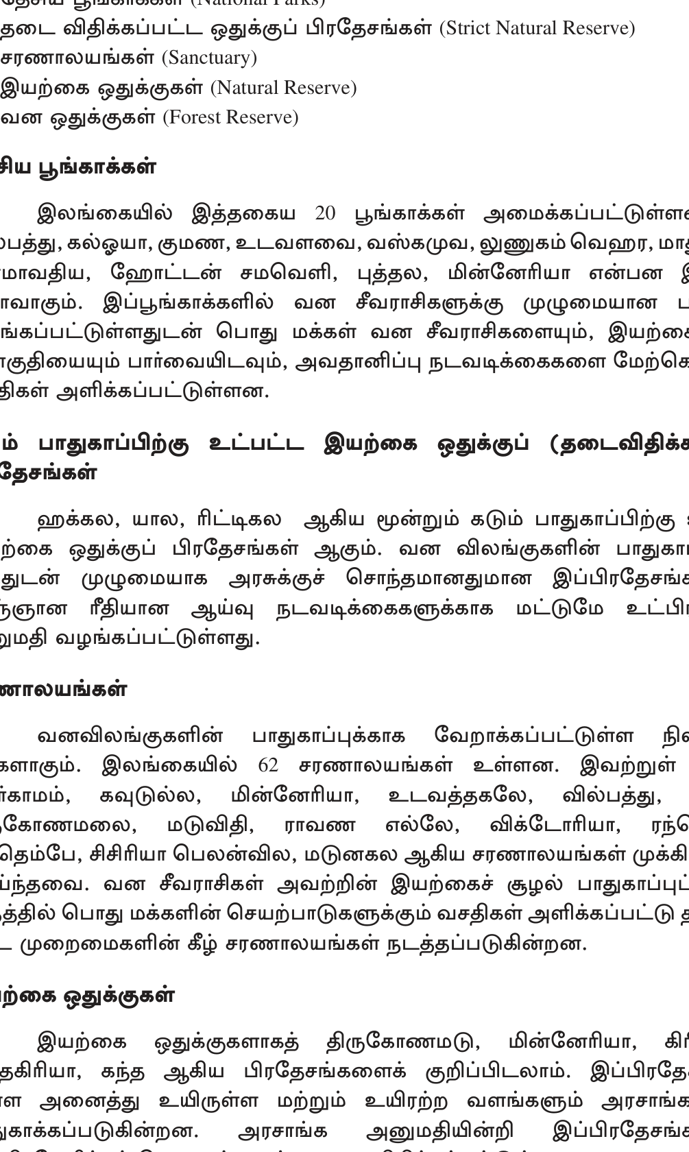
- National Parks (NP): Yala (largest by visitors — leopard density highest world!), Wilpattu (largest area ~131,693 ha), Wasgomuwa, Horton Plains, Bundala, Gal Oya, Udawalawe (elephants), Kumana, Minneriya (\"Gathering\" elephant phenomenon).
- Strict Nature Reserves: Hakgala, Yala Strict Nature Reserve.
- Forest Reserves: Sinharaja (UNESCO World Heritage), Knuckles (UNESCO), Kanneliya.
- Sanctuaries: bird sanctuaries (Kumana, Bundala).
- Biosphere Reserves: Sinharaja, Bundala, Hurulu, Kanneliya-Dediyagala-Nakiyadeniya.
- UNESCO World Heritage (Natural): Sinharaja Forest Reserve + Central Highlands (Horton Plains + Knuckles + Peak Wilderness).
காடழிப்பு (Deforestation)
ஆரம்பத்தில் (1881) நிலப்பரப்பின் ~84% காடாக இருந்தது; 1950இல் ~44%; தற்போது ~29% மட்டுமே. இதற்கான காரணங்கள்: chena cultivation, plantation expansion (tea/coffee/rubber 19th century, oil palm 21st century), encroachment, hydropower reservoirs, roads, urban. இவையே காடழிப்புக்கான முக்கிய காரணங்களாகும். பாதுகாப்பு முயற்சிகள்: Mahaweli Environmental Action Plan, National Conservation Strategy, FAO + IUCN partnerships.
4. மண் வளம் (Soil Resources)
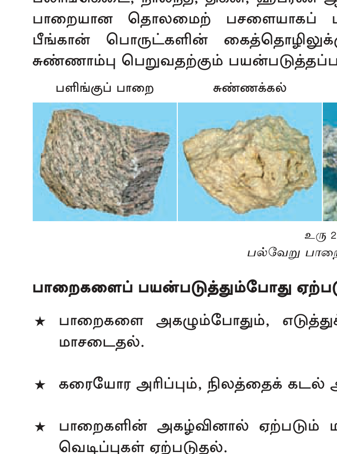
இலங்கையின் முக்கிய மண் வகைகள்:
- Reddish Brown Earth (RBE) — Dry zone, Anuradhapura/Polonnaruwa/Kurunegala. நெல் செய்கைக்கும் கலப்புப் பயிர்களுக்கும் ஏற்றது; நீர் வடிந்து செல்லும் தன்மை (drainage) சிறந்தது.
- Red Yellow Podzolic (RYP) — Wet zone hills, Kandy/Ratnapura/Galle. Tea, rubber, coconut. Iron-leached.
- Low Humic Gley — Low-lying wet areas, valley bottoms. Paddy.
- Alluvial — River floodplains (Mahaweli, Kelani, Walawe). High fertility, paddy.
- Reddish Brown Latosolic — Mid country, Wet/Intermediate zone.
- Regosols + Solonchak — Coastal dunes; sandy + saline. Casuarina + coconut.
- Lithosols — Mountain slopes; shallow, rocky.
- Bog + Half-bog — Swamps; organic-rich.
இலங்கையின் மண்ணை Soil Survey Department (Peradeniya) 14 முக்கிய மண் குழுக்களாக வகைப்படுத்தியுள்ளது.
5. கனியங்கள் (Mineral Resources)
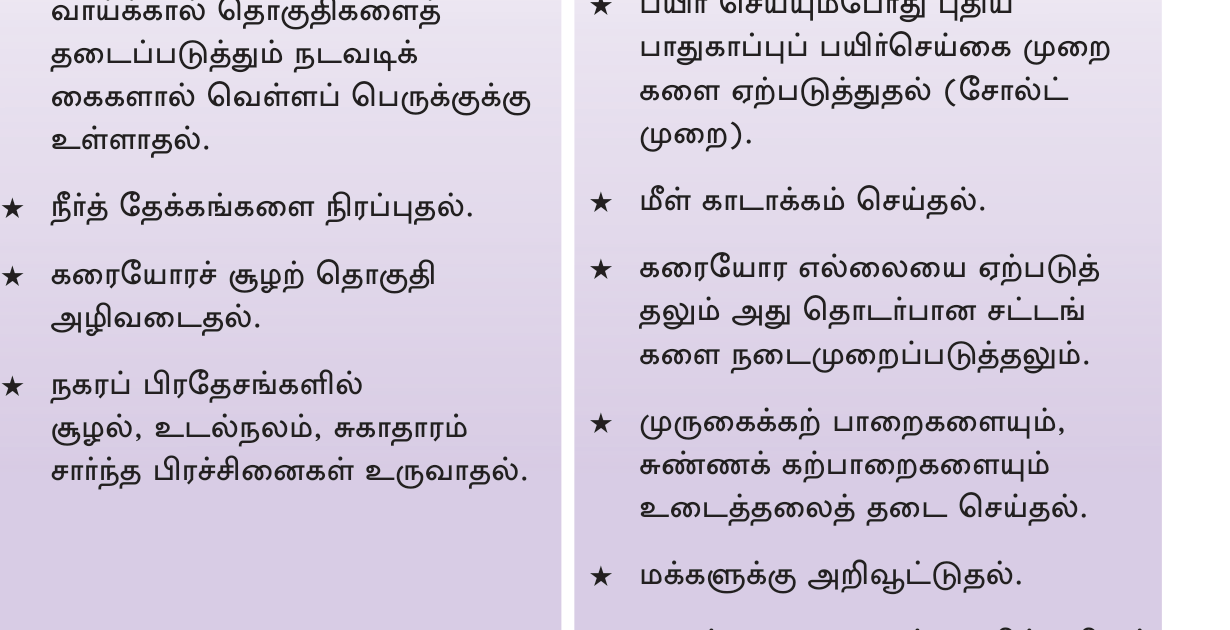
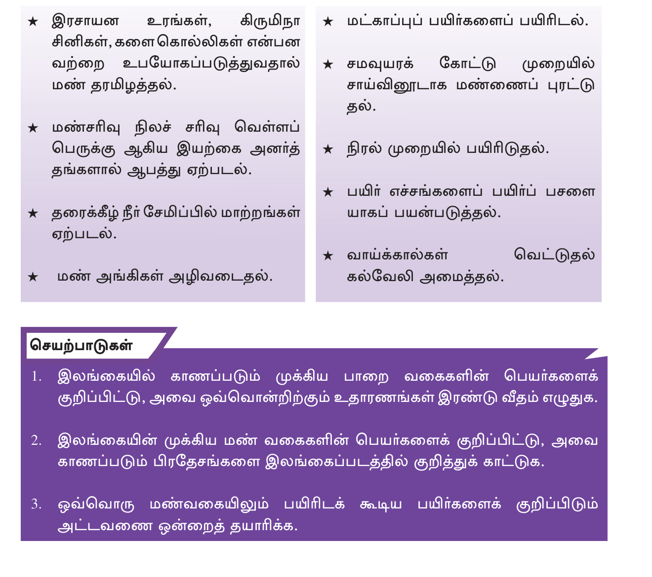
(அ) கிராப்பைட் (Graphite): உலகின் சிறந்த தரம்
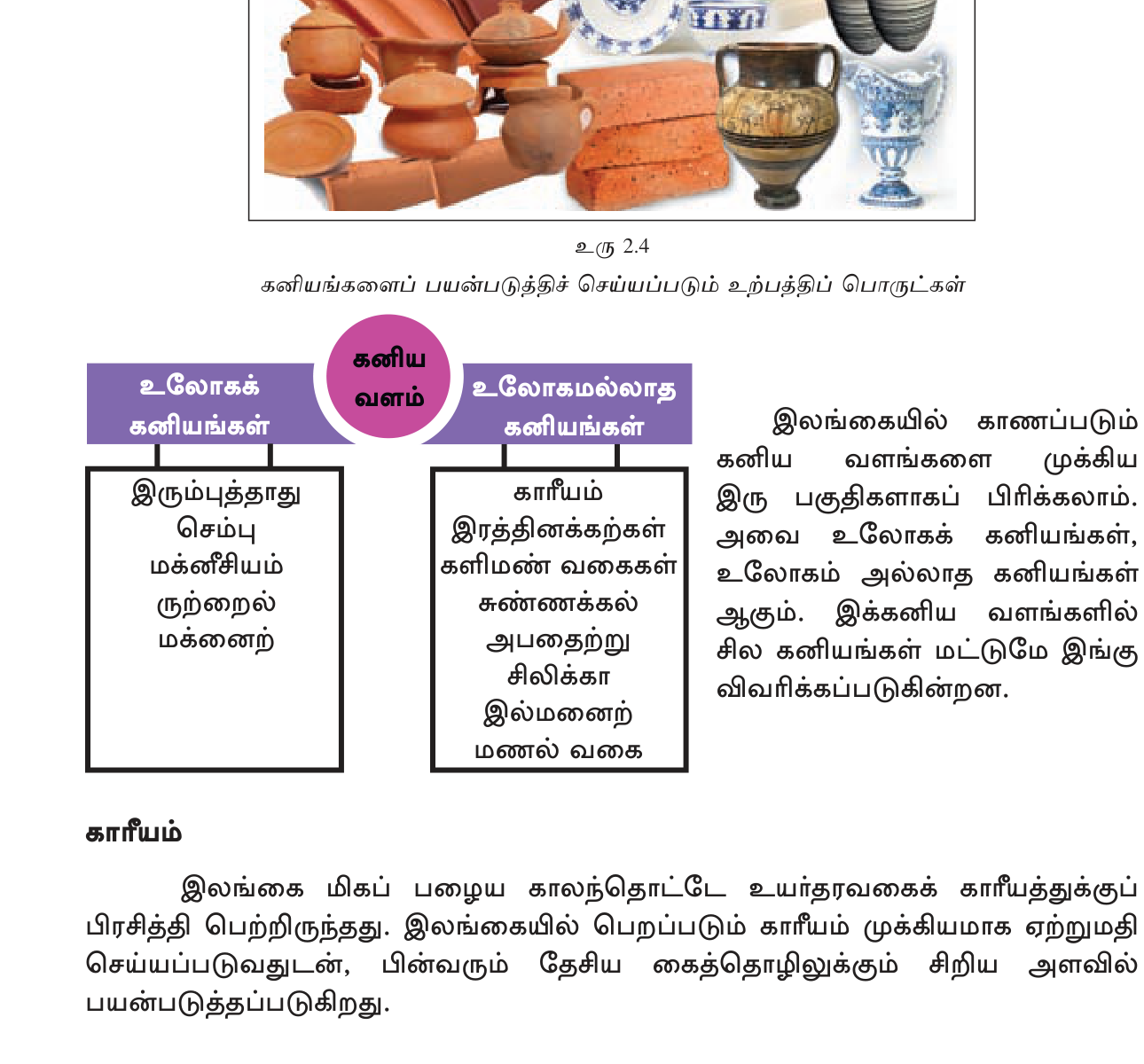
இலங்கையின் கிராப்பைட் vein graphite எனப்படும் நரம்புவடிவக் கிராப்பைட் ஆகும்; அதில் 95-98% தூய காபன் உள்ளது. எனவே இது உலகின் சிறந்த தரமுடையது. மற்ற நாடுகளில் காணப்படும் amorphous அல்லது flake graphite ~85-90% மட்டுமே தூய்மையானது. முக்கிய சுரங்கங்கள்:
- Bogala (Aruggammana, Kegalle) — biggest, deepest (560m).
- Kahatagaha-Kolongaha (Dodangaslanda) — state mine.
- Ragedara.
உலக கிராப்பைட் உற்பத்தியில் இலங்கையின் பங்கு சிறியது (~1%); ஆனால் தூய vein graphite உற்பத்தியில் இலங்கை ஏகபோக நிலையில் உள்ளது. பயன்பாடுகள்: lithium-ion battery anodes, pencils, lubricants, crucibles, electrodes, brake linings.
(ஆ) Gem Stones (இரத்தினங்கள்)
இலங்கை \"Ratna Deepa\" (இரத்தினத் தீவு) என அழைக்கப்படுகிறது. Ratnapura (\"City of Gems\") இரத்தினச் சுரங்கத் தொழிலின் முதன்மை மையமாகும். முக்கிய இரத்தினங்கள்:
- Blue Sapphire (இலங்கையில் உலகப் புகழ் பெற்றது; \"Ceylon Sapphire\" எனப்படுகிறது; உதாரணம்: Princess Diana ring).
- Star Sapphire + Star Ruby.
- Cat's Eye (Chrysoberyl) — Sri Lanka world's #1.
- Alexandrite — color-change.
- Topaz, Garnet, Tourmaline, Spinel, Zircon, Moonstone.
முக்கிய இரத்தினப் பகுதிகள் (gem fields): Ratnapura, Elahera, Okkampitiya, Pelmadulla. இத்துறையை National Gem & Jewellery Authority (NGJA) regulates. Annual gem exports ~$150-300 million.
(இ) Mineral Sands (கடற்கரை மணல் கனியம்)
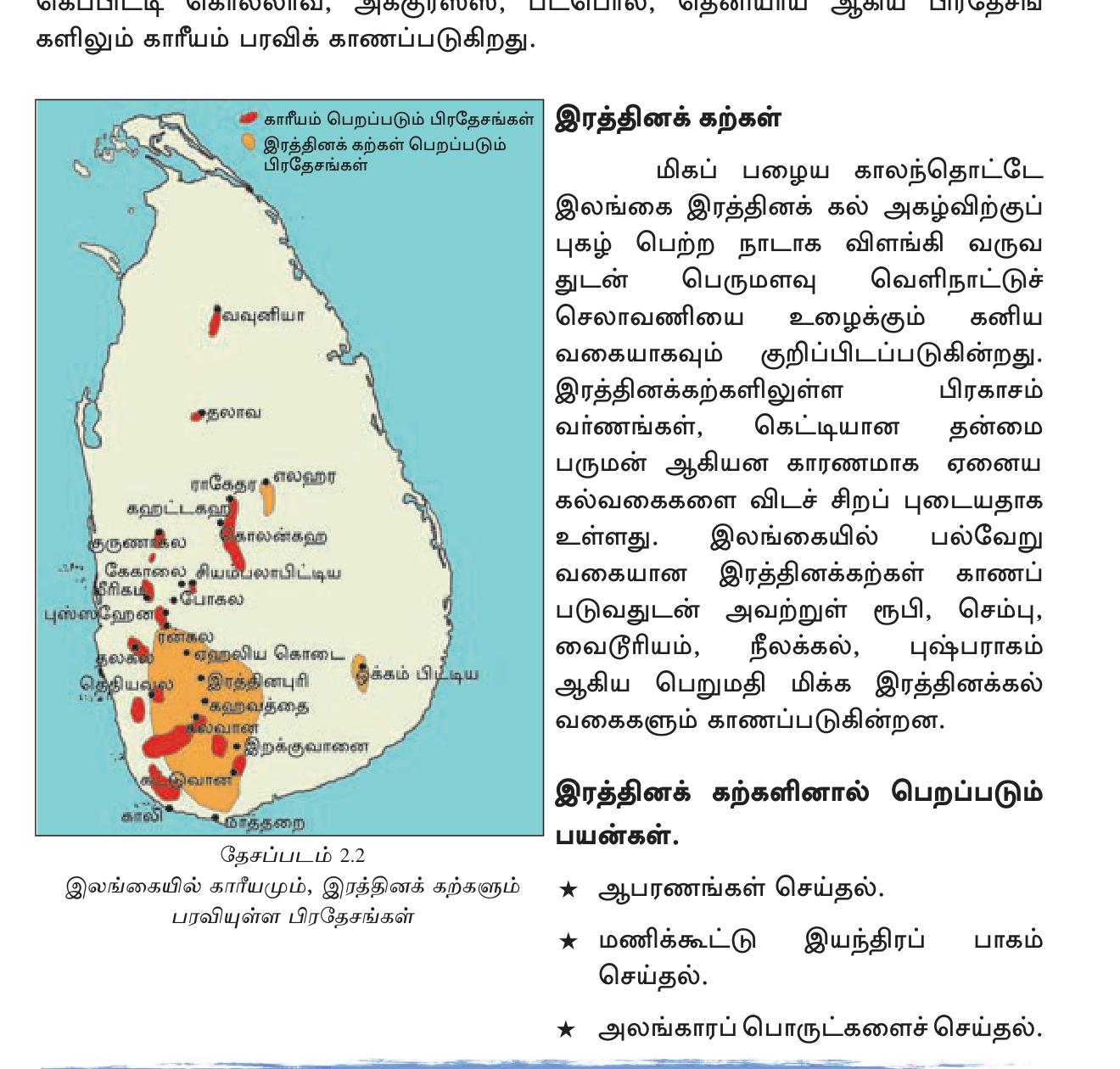
Pulmoddai (Trincomalee district, வடகிழக்குக் கடற்கரை) முக்கிய கனிய மணல் படிவாகும். கடற்கரை மணலில் கிடைக்கும் கனிய வகைகள் ஆங்கிலத்தில் heavy minerals:
- Ilmenite (FeTiO₃) — titanium dioxide (paint pigment).
- Rutile (TiO₂) — high-grade titanium; aircraft, surgical implants.
- Zircon (ZrSiO₄) — ceramics, refractories, nuclear.
- Monazite — rare earth elements + thorium (potential nuclear fuel).
- Garnet, Sillimanite.
Lanka Mineral Sands Ltd (LMSL) operates Pulmoddai. Annual production ~70,000 tons; export to China, Japan, USA for titanium industry.
(ஈ) பிற கனியங்கள் (Other Minerals)
- Limestone (சுண்ணாம்புக் கல்) — Puttalam (Aruwakkalu — Holcim/INSEE), Jaffna Peninsula (KKS), Eppawala. Cement primary raw.
- Dolomite — Matale, Digana. Fertilizer, glass.
- Quartz + Feldspar — Owala, Polgolla. Ceramics, glass.
- Clay (kaolin) — Boralesgamuwa, Dedigama. Ceramics (Noritake, Dankotuwa).
- Mica — Matale. Electrical insulators.
- Apatite (Eppawala phosphate) — fertilizer (rock phosphate).
- Salt — Hambantota, Puttalam (sea salt evaporation pans).
- Granite — Tantirimale, Habarana. Construction, export.
6. கடல் வளம் (Maritime Resources)
EEZ ~517,000 km² (நாட்டின் நிலப்பரப்பான 65,610 km²-ஐ விடச் சுமார் 7 மடங்கு). மீன்பிடி (Fishing) கடற்கரை, ஆழ்கடல், உள்நாட்டு நீர்நிலைகளில் நடைபெறுகிறது. சூரை மீன் (Tuna) ஏற்றுமதி செய்யப்படுகிறது. கடலோரச் சுற்றுலாவும் துறைமுகங்களும் (Colombo, Hambantota, Trincomalee) உள்ளன. Offshore oil & gas exploration (Mannar Basin) — promising but undeveloped. Sand mining + coral aggregates (regulated).
7. சக்தி வளம் (Energy Resources)
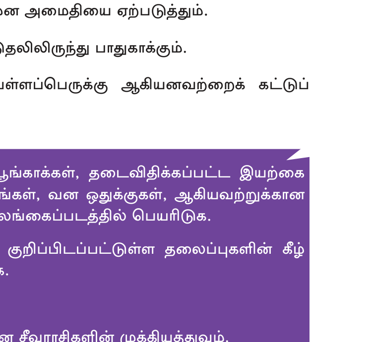
(அ) Hydro (நீர்மின்சாரம்)
இலங்கையின் மிகப் பழைமையான, தூய்மையான சக்தி மூலம் இதுவாகும். Mahaweli Complex (Victoria 210 MW, Kotmale 201 MW, Randenigala 126 MW, Rantembe 51 MW, Ulhitiya-Rathkinda). Laxapana Complex (New Laxapana 100 MW, Wimalasurendra 50 MW, Old Laxapana 50 MW). Samanalawewa 120 MW. Total installed hydro ~1700 MW; ~30% national grid.
(ஆ) Thermal (Coal + Oil)
Norochcholai Coal Power Plant (Lakvijaya, Puttalam) — 900 MW, Chinese-built (CMEC), 2011 commissioned. ~35% national electricity. Sapugaskanda Refinery (oil → diesel power stations). Kelanitissa CCGT (combined-cycle gas turbine). 100% coal + oil imported (Russia, Saudi, UAE).
(இ) Renewables (Wind, Solar, Biomass)
Wind: Mannar Wind Farm (100 MW, expandable to 250+ MW). Hambantota, Kalpitiya pilot. Total
~250 MW.
Solar: rooftop PV (\"Soorya Bala Sangramaya\" 2016 scheme); Hambantota Welikanda solar; total
~700 MW grid + small.
Biomass: rice husk, sugarcane bagasse, dendro plantations.
Geothermal: not significant.
Target: 70% renewable electricity by 2030.
8. வளப் பாதுகாப்பும் சவால்களும்
- நீர் மாசடைதல்: தொழிற்சாலைக் கழிவுகள் (Industrial effluent; Kelani ஆறு), விவசாய இரசாயனங்கள் (agro-chemicals; CKDu எனப்படும் வரண்ட வலயச் சிறுநீரக நோய்).
- காடழிப்பு: சேனைப் பயிர்ச்செய்கையும் (chena) விவசாயத்துக்கான ஆக்கிரமிப்பும் (encroachment) காரணங்களாகும்.
- மண் அரிப்பு: மத்திய மலைநாட்டின் தேயிலைச் சரிவுகளில் (tea slopes) ஏற்படுகிறது.
- Sand mining — Ma Oya, Deduru Oya — destructive.
- Coral / sea — reef bleaching, over-fishing.
- Energy import dependency — coal + oil ~50%+ import bill.
பாதுகாப்பு நிறுவனங்கள்
- Department of Wildlife Conservation (DWC) — National Parks.
- Forest Department — Forest Reserves.
- Central Environmental Authority (CEA) — pollution control + EIA.
- Mahaweli Authority — irrigation + watershed.
- NARA — aquatic + coastal research.
- Geological Survey & Mines Bureau (GSMB) — mineral exploration + regulation.
- Sustainable Energy Authority (SEA) — renewable energy promotion.
- நிலம் 65,610 km²; EEZ 517,000 km² (7×). 103 ஆறுகள் · Mahaweli 335 km longest.
- 4000+ ancient tanks. Parakrama Samudra (Polonnaruwa) = largest (2500 ha).
- காடு 29% (down from 84% in 1881). UNESCO Sinharaja + Central Highlands.
- Major National Parks: Yala (visitors), Wilpattu (area), Wasgomuwa, Horton Plains, Bundala, Udawalawe (elephants), Minneriya (gathering).
- Soil: RBE (dry zone), RYP (wet zone hills), Alluvial (river), Lithosol (mountain). 14 major groups.
- Graphite — Bogala/Kahatagaha/Ragedara — world's highest purity vein graphite (95-98%).
- Gems — Ratnapura "City of Gems". Blue sapphire + cat's eye world-famous.
- Mineral sands — Pulmoddai (Trincomalee NE coast). Ilmenite, rutile, zircon, monazite.
- Limestone: Puttalam (Aruwakkalu), KKS (Jaffna). சிமெண்டின் முதன்மை மூலப்பொருள்.
- Energy mix: coal 35% (Norochcholai 900MW), hydro 30%, oil 20%, renewable 15%. Target 70% renewable by 2030.
- Mahaweli hydro: Victoria 210MW, Kotmale 201MW, Randenigala 126MW.
- Wind: Mannar (100MW + expansion).
- EEZ என்பது கடற்கரையின் நீளம் அல்ல. EEZ என்பது 517,000 km² பரப்பாகும்; கடற்கரை 1,340 km நீளமுடையது.
- Mahaweli 335 km (NOT 235); அதுவே இலங்கையின் மிக நீளமான ஆறு.
- Parakrama Samudra (Polonnaruwa) vs Senanayake Samudra (Gal Oya) — Parakrama = ancient (Polonnaruwa king); Senanayake = modern (1950s D.S. Senanayake era).
- UNESCO heritage = Sinharaja + Central Highlands (Horton Plains + Knuckles + Peak Wilderness) — Yala/Wilpattu NPs UNESCO அல்ல.
- Yala = leopard density (highest in world); Wilpattu = largest area; Udawalawe = elephants; Minneriya = gathering phenomenon.
- Graphite: அளவில் சிறியது (உலகில் 1%) ஆனால் தரத்தில் #1. இதைக் குழப்பிக்கொள்ளாதே.
- Ilmenite இரும்புத் தாது அல்ல. Ilmenite (FeTiO₃) என்பது titanium dioxide பெறப்படும் கனியம்; அது titanium பெறுவதற்கான மிக மலிவான மூலமாகும்.
- Norochcholai = coal power, Sapugaskanda = oil refinery. Both Puttalam district but different roles.
- Bogala graphite mine = Kegalle district (NOT Anuradhapura).
- Ratnapura ≠ Anuradhapura. Ratnapura = gems (Sabaragamuwa); Anuradhapura = ancient capital (North Central).
✅ விரைவுச் சோதனை
முக்கியக் கருத்துக்களை உறுதிப்படுத்துங்கள். தவறான விடைகள் உங்கள் தவறுக் குறிப்பேட்டில் சேமிக்கப்படும்.
🖊 கட்டுரை வினாக்கள் (பகுதி II)
பரீட்சை வடிவில் கட்டமைப்பு வினாக்கள். முதலில் நீங்களே எழுதுங்கள்; பின்னர் மாதிரி விடையைத் திறந்து சரிபாருங்கள்.
விடைத் திட்டம் — சேர்க்க வேண்டிய புள்ளிகள்:
- SW + NE monsoons; annual avg ~1860mm; wet zone 2500+; dry <1250
- 103 rivers radial; Mahaweli 335km longest
- 4000+ ancient tanks (Anuradhapura/Polonnaruwa kings)
- Parakrama Samudra 2500ha largest
- Kala Wewa, Senanayake Samudra (modern, Gal Oya)
- Groundwater: Jaffna limestone aquifer, Kalpitiya
- Saltwater intrusion threat (Jaffna)
**மழை:** ஆண்டு சராசரி ~1860 mm. பகிர்வு unequal — மலையோர wet zone (Watawala, Nuwara Eliya) 5000+ mm; dry zone (Anuradhapura, Hambantota) <1250 mm. மழை இரு பருவக் காற்று வழியே — **SW Monsoon (Yala — May-Sep)** மலை + SW கடற்கரை, **NE Monsoon (Maha — Oct-Feb)** dry zone + வடகிழக்கு. Inter-monsoon convectional rain (March-April, October).
**ஆறுகள் (Rivers):** 103 perennial rivers — central highlands (Sri Pada area) radial pattern. **Mahaweli (335 km)** — longest, drains to Trincomalee Bay; supports Mahaweli Development Project (largest SL irrigation+hydropower scheme). பிற முக்கிய: Kelani (145km — flows Colombo), Walawe (138), Kalu (129), Malwathu Oya (Aruvi Aru — Anuradhapura), Yan Oya, Deduru Oya, Maha Oya.
**பழம் தடாக நாகரிகம் (Ancient Tank Civilization):** 3000+ ஆண்டு வரலாறு. Anuradhapura + Polonnaruwa கால சிங்களவ அரசர்கள் (Vasabha 67-111 AD, Mahasen, Dhatusena, Parakramabahu I 12th c.) கட்டிய **4000+ tanks** — "tank cascade" system in dry zone catchments. முக்கியம்:
- **Parakrama Samudra** (Polonnaruwa — 2500 ha; "Sea of Parakrama")
- **Kala Wewa** (Anuradhapura — Dhatusena 5th c.)
- **Tissa Wewa, Nuwara Wewa, Yoda Wewa**
- **Senanayake Samudra** (Gal Oya — modern 1950s, D.S. Senanayake era; largest modern reservoir).
இவை வரண்ட வலயத்தின் நெல் களஞ்சியத்திற்கு அடிப்படை — Maha + Yala paddy.
**நிலத்தடி நீர் (Groundwater):** Jaffna Peninsula limestone aquifer (shallow, vulnerable to saltwater intrusion from over-extraction); North Western Kalpitiya sand aquifer; deep aquifers in Mahaweli alluvium. முக்கிய issue — over-pumping → saline contamination.
**Issues:** climate change-driven monsoon variability; Kelani river industrial pollution; dry zone CKDu suspected agro-chemical/fluoride water cause; sand mining destroying river beds.
**Management:** Mahaweli Authority, Irrigation Department, NWS&DB (drinking water), CEA pollution control.
விடைத் திட்டம் — சேர்க்க வேண்டிய புள்ளிகள்:
- 29% forest (down from 84% in 1881)
- Biodiversity hotspot — endemic species
- Forest types: wet evergreen, sub-montane, montane cloud, dry mixed, mangrove, savanna
- National Parks: Yala, Wilpattu, Wasgomuwa, Horton Plains, Bundala, Udawalawe, Minneriya
- UNESCO: Sinharaja + Central Highlands
- Forest reserves: Sinharaja, Knuckles, Kanneliya
- Conservation institutions: DWC, Forest Dept, CEA
- Deforestation drivers: chena, plantations, encroachment
**Biodiversity Hotspot:** Endemic plants (~830 endemic, 60% of total flora), endemic vertebrates (Sri Lankan leopard, purple-faced langur, sloth bear, Sri Lanka junglefowl), 433 bird species (33 endemic). Conservation International-ன் 36 global biodiversity hotspots-இல் ஒன்று (Western Ghats + SL hotspot).
**Forest Types (7 major):**
1. **Tropical Wet Evergreen** — Sinharaja, Kanneliya, Kanugala. 2500+mm; year-round leaves.
2. **Tropical Sub-montane** — 900-1500m; Hakgala.
3. **Montane Cloud Forest** — 1500m+; Horton Plains, Pidurutalagala. Mossy, foggy.
4. **Tropical Moist Mixed Evergreen** — intermediate zone.
5. **Tropical Dry Mixed Evergreen** — Wilpattu, Yala dry zone. Deciduous tendency.
6. **Mangroves** — Negombo Lagoon, Madu Ganga, Puttalam, Trincomalee — coastal salt-tolerant.
7. **Savannah + Patana grassland** — Horton Plains, mountain patanas, dry zone scrub.
**Protected Areas (~30% of land in some form):**
- **National Parks:** Yala (leopard density highest world!), Wilpattu (~131,693 ha, largest area, "land of lakes"), Wasgomuwa, Horton Plains, Bundala (Ramsar wetland, flamingos), Gal Oya (largest tank), Udawalawe (elephants 400+, Elephant Transit Home), Kumana (birds), Minneriya ("Gathering" 200-300 elephants Aug-Sep).
- **Strict Nature Reserves:** Hakgala, Yala SNR.
- **Forest Reserves:** Sinharaja (UNESCO 1988), Knuckles (UNESCO 2010 as part of Central Highlands), Kanneliya-Dediyagala-Nakiyadeniya.
- **Sanctuaries:** Kumana bird, Bundala (Ramsar), Madu Ganga.
- **Biosphere Reserves (UNESCO MAB):** Sinharaja, Bundala, Hurulu, Kanneliya complex.
- **UNESCO World Natural Heritage:** Sinharaja Forest Reserve (1988) + Central Highlands (2010 — Horton Plains + Knuckles + Peak Wilderness).
**Conservation Institutions:**
- **Department of Wildlife Conservation (DWC)** — National Parks + Sanctuaries.
- **Forest Department** — Forest Reserves + non-NP forests.
- **Central Environmental Authority (CEA)** — pollution + EIA.
- **Ministry of Environment** — policy.
**Deforestation History + Drivers:** 1881 ~84% → 1950 ~44% → 2020 ~29%. British coffee + tea + rubber plantations (19th c.) deforested mid-country. Subsequent: chena (slash-and-burn shifting cultivation), oil palm expansion (21st c.), urban encroachment, hydropower reservoirs (Mahaweli flooded large areas), illegal logging.
**Future:** SL committed to 32% forest cover by 2030; reforestation programs (Re-Greening Sri Lanka), community forestry, eco-tourism revenue sharing.
விடைத் திட்டம் — சேர்க்க வேண்டிய புள்ளிகள்:
- Graphite Bogala/Kahatagaha — world's highest purity vein (95-98%)
- Gems Ratnapura — blue sapphire, cat's eye world #1
- Mineral sands Pulmoddai — ilmenite, rutile, zircon, monazite
- Limestone Puttalam Aruwakkalu — cement
- Other: dolomite, quartz, clay, mica, apatite Eppawala, salt, granite
- Economic value: graphite niche, gems export $150-300M, mineral sands export, cement local
- GSMB regulates
**(1) Graphite — உலகின் சிறந்த தர.**
இலங்கை graphite = **vein graphite** (cracks-இல் hydrothermal deposit), **95-98% pure carbon** — மற்ற நாடுகளில் amorphous/flake graphite 85-90% pure. சுரங்கங்கள்:
- **Bogala** (Aruggammana, Kegalle) — biggest, deepest (560m vertical shaft), continuously operated since 1880s.
- **Kahatagaha-Kolongaha** (Dodangaslanda) — state-owned.
- **Ragedara**.
உலக graphite production-இல் SL ~1% அளவில் ஆனால் pure vein-இல் near-monopoly. பயன்: **lithium-ion battery anodes (EV revolution!)**, pencils, lubricants, brake linings, crucibles, electrodes, conductors. Tesla, Panasonic batteries SL graphite source. Export ~$30M/year.
**(2) Gems — "Ratna Deepa" (Gem Island).**
**Ratnapura** ("City of Gems", Sabaragamuwa Province) = primary gem mining hub. மற்ற fields: Elahera (Matale), Okkampitiya (Monaragala), Pelmadulla. Sapphires, rubies, cat's eyes, alexandrites, garnets, topaz, tourmaline, spinels, zircons, moonstones.
SL world-famous: **Blue Sapphire** ("Ceylon Sapphire" — Princess Diana / Kate Middleton 12-carat engagement ring; Logan Sapphire 423 ct), **Star Sapphire** (Star of India 563 ct — American Museum of Natural History), **Cat's Eye Chrysoberyl** (SL world #1 supplier), **Star Ruby**, **Alexandrite** (colour-changing). Annual gem exports ~$150-300 million. **National Gem & Jewellery Authority (NGJA)** regulates trade + certification.
**(3) Mineral Sands — Pulmoddai.**
Pulmoddai (Trincomalee district NE coast) heavy mineral sand deposit — formed by sea currents concentrating dense minerals on beach.
- **Ilmenite (FeTiO₃)** — titanium dioxide pigment (paint, plastics, sunscreen).
- **Rutile (TiO₂ pure)** — high-grade titanium (aircraft, surgical implants).
- **Zircon (ZrSiO₄)** — ceramics, refractories, nuclear cladding.
- **Monazite** — rare earth elements (REE) + thorium (future nuclear).
- **Garnet, Sillimanite** — abrasives + refractory.
Lanka Mineral Sands Ltd (LMSL) state operator; annual production ~70,000 tons; export China, Japan, USA. மற்ற pilots: Beruwala (small).
**(4) Limestone (சுண்ணாம்புக் கல்) — Cement.**
- **Aruwakkalu** (Puttalam — Holcim Lanka / INSEE Cement; nation's biggest cement plant).
- **Kankesanthurai (KKS)** (Jaffna Peninsula — historic Holcim/SLCC).
- **Eppawala** (Anuradhapura).
SL cement industry partially self-sufficient; clinker imported also.
**(5) பிற Important Minerals:**
- **Dolomite** — Matale, Digana — agricultural lime, glass.
- **Apatite/Phosphate** — **Eppawala** (Anuradhapura — Lanka Phosphate Ltd) — fertilizer.
- **Salt** — Hambantota (Lanka Salt Ltd), Puttalam — solar evaporation pans.
- **Quartz + Feldspar** — Owala, Polgolla — ceramics (Noritake, Dankotuwa porcelain).
- **Clay (Kaolin)** — Boralesgamuwa, Dedigama — ceramics, bricks.
- **Mica** — Matale.
- **Granite** — Tantirimale, Habarana — construction, export to Middle East.
**Regulator:** **Geological Survey & Mines Bureau (GSMB)** — exploration + licensing + EIA + revenue sharing.
விடைத் திட்டம் — சேர்க்க வேண்டிய புள்ளிகள்:
- Energy mix: coal 35% + hydro 30% + oil 20% + RE 15%
- Hydro: Mahaweli complex (Victoria 210MW etc) + Laxapana + Samanalawewa, total ~1700MW
- Coal: Norochcholai 900MW (Chinese 2011)
- Oil: Sapugaskanda refinery 50,000 bpsd; Kelanitissa CCGT
- Wind: Mannar 100MW + expansion
- Solar: Soorya Bala Sangramaya rooftop + Hambantota
- Biomass: rice husk, dendro
- Target: 70% renewable by 2030
- Challenges: 100% coal+oil import, EV future
**Current Energy Mix (~2023 grid electricity):**
- **Coal ~35%** — Norochcholai Lakvijaya Power Plant only.
- **Hydro ~30%** — Mahaweli + Laxapana + Samanalawewa complexes.
- **Oil ~20%** — diesel + fuel oil thermal stations.
- **Renewables ~15%** — wind, solar, biomass, small hydro.
**(அ) Hydro (நீர்மின்சாரம்) ~30%:**
SL's oldest + cleanest source. Total installed capacity ~1700 MW.
- **Mahaweli Hydro Complex:** Victoria (210 MW — largest, UK aid 1985), Kotmale (201 MW), Randenigala (126 MW), Rantembe (51 MW), Ulhitiya-Rathkinda.
- **Laxapana Complex (Castlereagh-Maussakelle):** New Laxapana 100 MW, Wimalasurendra 50 MW, Old Laxapana 50 MW, Polpitiya 75 MW.
- **Samanalawewa** 120 MW (Walawe basin).
- **Kukule Ganga** 70 MW (Sinharaja foothills).
- **Mini/Small hydro** ~400 MW (private investor + community).
Limitation: monsoon-dependent (dry year = power crisis 1996, 2017, 2024). Most major sites already developed.
**(ஆ) Coal (Thermal) ~35%:**
**Norochcholai (Lakvijaya) Power Plant** — Puttalam district NW coast. 3 × 300 MW = 900 MW total. Built by China Machinery Engineering Corp (CMEC) — $1.35 billion loan; commissioned 2011-14. 100% coal imported (Russia, South Africa, Indonesia). ~35% national electricity. Operational issues — multiple breakdowns, cost overruns.
**(இ) Oil (Petroleum) ~20%:**
- **Sapugaskanda Oil Refinery** (CPC, 1969, Iranian tech) — 50,000 bpsd; crude imported (Saudi/UAE/Russia/Oman); products petrol/diesel/kerosene/jet fuel/LPG/naphtha/asphalt.
- **Kelanitissa Combined Cycle Gas Turbine (CCGT)** 165+165 MW — runs on naphtha + LSFO + diesel.
- **Sapugaskanda thermal** — diesel-fired peaker.
- 2022 fuel crisis — forex shortage halted oil imports, blackouts.
**(ஈ) Renewables ~15%:**
- **Wind:** Mannar Wind Farm (Adani / CEB JV, 100 MW commissioned 2024, expansion to 250+ MW planned). Smaller sites Kalpitiya, Hambantota.
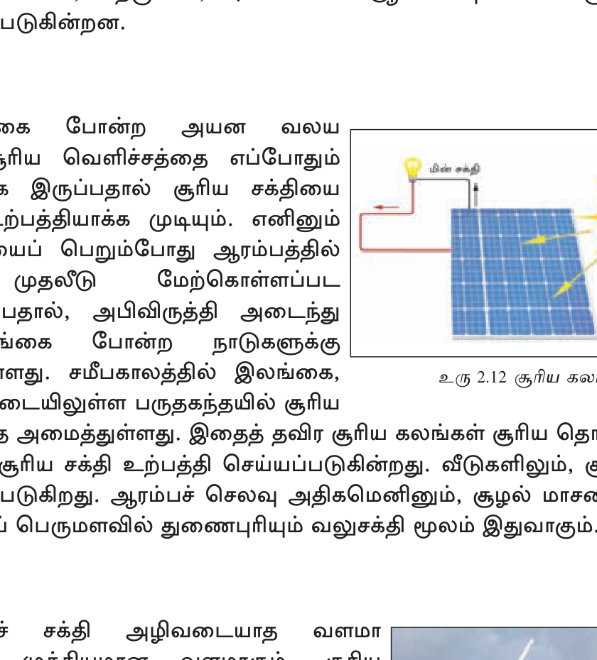
- **Solar:** "Soorya Bala Sangramaya" (Battle of Solar Energy) 2016 rooftop PV scheme — net metering for households + businesses; ~700 MW installed. Hambantota Welikanda solar park 100 MW. Multiple ground-mount plants.
- **Biomass:** rice husk power plants (CEB pilots), sugarcane bagasse cogeneration, dendro (Gliricidia) wood plantations for fuel.
- **Geothermal:** essentially zero (no volcanic activity).
- **Wave/Tidal:** pilots only.
**Target:** **70% renewable electricity by 2030** — ambitious. Implementation includes: 3000+ MW solar PV, 1500+ MW wind, additional small hydro, biomass + biogas. Battery storage critical for intermittency. Grid modernization needed.
**Challenges:**
1. **100% coal + oil imported** — forex burden + geopolitics (Russia-Ukraine 2022 oil spike).
2. **CEB financial losses** — tariff < cost recovery; political pricing.
3. **Grid bottleneck** — northern + eastern transmission lines for Mannar/Pulmoddai renewables.
4. **Land + community opposition** — wind/solar farms vs farmland/forests.
5. **EV revolution** — future electric vehicle adoption needs grid expansion + green generation.
6. **2022 economic crisis** — fuel scarcity exposed import dependency.
**Future moves:** LNG import terminal (Kerawalapitiya), Hambantota 2nd refinery (Sinopec — delayed), Mannar Basin offshore oil/gas exploration (Cairn India, Total, ExxonMobil prior interest), hydrogen economy potential, EV transition + charging infrastructure.
விடைத் திட்டம் — சேர்க்க வேண்டிய புள்ளிகள்:
- 1968 Master Plan; 1977 acceleration
- Largest SL water resource development
- Catchment: Mahaweli basin (10,448 km²)
- 5 dams: Polgolla, Kotmale, Victoria, Randenigala, Rantembe
- Hydro ~700 MW + irrigation 365,000 ha
- Settled 1+ million people in dry zone
- New towns: Dehiattakandiya, Girandurukotte, etc.
- Environmental concerns: forest loss, displaced people, biodiversity
**வரலாறு:**
- 1958 - பரிசீலனை தொடக்கம் (UN expert mission).
- **1968 - UNDP/FAO Mahaweli Master Plan** approved.
- 1970s - வேலைத் தொடக்கம், மெதுவாக.
- **1977 - Accelerated Mahaweli Programme (AMP)** under President J.R. Jayewardene. International aid (UK, Germany, Sweden, Japan, World Bank, ADB). 30-year plan compressed to 6 years.
- 1985 - முக்கிய dams commissioned.
- Ongoing - completion + maintenance + expansion to dry zone.
**Geographic Scope:**
Mahaweli river basin = 10,448 km² (16% of SL land area). Catchment spans wet zone central highlands → dry zone NCP/EP. River length 335 km — SL's longest.
**5 முக்கிய dams + reservoirs (in Mahaweli main stem):**
1. **Polgolla Barrage** (Kandy) — diverts water to dry zone via Sudu Ganga tunnel + Bowatenna reservoir.
2. **Kotmale Dam** (201 MW + Maskeliya tributary).
3. **Victoria Dam** (210 MW — largest; UK aid; impressive 122m arch dam).
4. **Randenigala Dam** (126 MW).
5. **Rantembe Dam** (51 MW — last in cascade).
Plus subsidiary: Ulhitiya, Rathkinda, Maduru Oya, Senanayake Samudra (Gal Oya).
**Key Outputs:**
- **Hydropower:** ~700 MW installed (Mahaweli Complex) — ~25% of national grid in wet years.
- **Irrigation:** 365,000 ha new + improved irrigation; ~600,000 ha eventually planned.
- **Resettlement:** 1+ million people resettled from wet zone (Kandy, Matale) + landless to new dry zone farms. New towns built: Dehiattakandiya, Girandurukotte, Aralaganwila, Welikanda.
- **Agricultural transformation:** dry zone became national paddy granary. Tobacco, sugarcane, soybean, banana also cultivated.
- **Drinking water:** several major town supplies fed by Mahaweli reservoirs.
**Environmental + Social Concerns:**
- **Forest clearance** — hundreds of thousands of hectares lost (Knuckles foothills, dry zone scrub).
- **Wildlife displacement** — elephants, leopards lost habitat → human-elephant conflict.
- **Sediment trapping** — dams reduce nutrient flow to downstream rice fields + coast.
- **Displacement trauma** — original wet zone communities relocated to harsh dry zone; cultural disruption.
- **Indigenous Vedda community** — Mahaweli zones overlap with traditional Vedda lands; rights violations.
- **Vector diseases** — malaria, dengue increased in new reservoir + irrigation areas.
- **Sectarian tensions** — dry zone resettlement involved Sinhalese-majority displacement to Tamil-majority Eastern Province; contributed to ethnic conflict.
**Management:** Mahaweli Authority of Sri Lanka (MASL) — statutory body. Operates dams + irrigation networks + tank cascades + settlement administration. Modernization ongoing — drip irrigation, water-use efficiency, climate adaptation.
**Legacy:** Despite criticism, MDP transformed SL agriculture, energy supply, regional development. தற்போது net food deficit nation → near self-sufficient in rice; nuclear power-saving via hydro; rural livelihoods of millions.
விடைத் திட்டம் — சேர்க்க வேண்டிய புள்ளிகள்:
- 11,187 ha; lowland rainforest in Sabaragamuwa + Southern provinces
- Last viable primary rainforest in SL
- UNESCO World Heritage 1988
- Biosphere Reserve 1978
- 60% endemic plants, 50%+ endemic vertebrates
- Climate: 3500-5000mm rain; year-round
- Threats: encroachment, mining, tourism pressure
- Conservation: Forest Dept management
**இருப்பிடம் + பரப்பு:** 11,187 ha; Sabaragamuwa Province (Ratnapura district) + Southern Province (Galle district) overlap. கொழும்பிலிருந்து ~150 km SE. பகுதி hills 200-1300m elevation.
**UNESCO ஏற்பு:**
- **1978** — UNESCO Man and Biosphere (MAB) Reserve.
- **1988** — UNESCO World Heritage Site (Natural Criteria ix + x: ecological/biological processes + biodiversity).
- 1996 — extended to include adjacent forests.
**Biodiversity:**
- **Endemic plants:** ~60% of woody plants endemic to SL; ~830 endemic flora total in SL much in Sinharaja.
- **Endemic vertebrates:** 50% of SL endemic mammals, reptiles, butterflies found here.
- **Birds:** 147 species + 33 SL endemic birds (e.g. Sri Lanka Blue Magpie, Red-faced Malkoha, Green-billed Coucal). Famous mixed-species flock phenomenon.
- **Mammals:** Purple-faced langur, leopard, fishing cat, mouse deer, otter, slender loris.
- **Reptiles:** SL endemic agamids, snakes, geckos.
- **Insects:** ~80 endemic butterfly species; world's only known place for some.
- **Plants:** Mesua nagassarium, Shorea spp. (dipterocarps — emergent canopy 40-50m tall), tree ferns, orchids, ginger.
**Climate:**
- Annual rainfall **3500-5000 mm** — among wettest in SL.
- Temperature 19-34°C, humidity 75-90% — year-round.
- Both SW + NE monsoons contribute.
**Geology + Hydrology:**
Precambrian basement rock; lateritic + reddish-brown soils. Several streams originate here — Kalu Ganga + Gin Ganga + Nilwala tributaries → water security for SW SL.
**Human History:**
Traditional gathering economy — Sinharaja villagers gather rattan, cardamom, beeswax, medicinal plants under controlled licenses. "Mae Vee" rice traditionally near forest edge.
**Threats:**
1. **Encroachment** — illegal cultivation, settlement (especially southern edge).
2. **Mining** — sand, gemstones in periphery.
3. **Roads + tourism pressure** — increasing visitor footfall (~50,000/year).
4. **Edge effects** — small + isolated patches near boundary degrade.
5. **Climate change** — altered rainfall, temperature stress.
6. **Invasive species** — eucalyptus, alstonia.
7. **Hydropower** — Kukule Ganga reservoir on edge.
**Conservation Management:**
- **Forest Department** (Sri Lanka Sustainable Tourism Authority + IUCN) joint management.
- Buffer zone (1.4 km wide) regulates extraction.
- Visitors must be accompanied by trained naturalist guides — research permits required.
- Local community livelihood programs (eco-tourism guide certification, handicrafts).
- Continuous biodiversity research (national + international universities).
**Visitor Access:** Kudawa entrance (Kalawana, Ratnapura side — main) + Pitadeniya entrance (southern, Deniyaya). Day tours and overnight stays in surrounding ecolodges.
**Significance:** "Sinharaja is to Sri Lanka what Galapagos is to Ecuador" — biological isolation + endemism scientific value. Last remaining primary lowland rainforest in SL — once lost, gone forever.
விடைத் திட்டம் — சேர்க்க வேண்டிய புள்ளிகள்:
- EEZ = 200 NM (~370 km) from coast; ~517,000 km²
- 7x larger than SL landmass
- UNCLOS 1982 framework
- Exclusive rights: fishing, seabed minerals, energy, marine research
- Tuna export ~$300M; potential offshore oil Mannar Basin
- Indian Ocean strategic location
- Maritime disputes: India fishermen, Maldives boundary
- Defence + naval needs
**Sri Lanka's EEZ:**
- கடற்கரை = 1,340 km.
- EEZ = **~517,000 km²** = நாட்டு நிலப் பகுதியின் (65,610 km²) **7 மடங்கு**.
- Indian Ocean பகுதி; Bay of Bengal + Arabian Sea + south Indian Ocean overlap.
**UNCLOS 1982 Framework:**
Sri Lanka 1982 signed, 1994 ratified. 200 NM EEZ universal standard. Within EEZ:
- **Exclusive Sovereign Rights:** fishing, mineral extraction, offshore oil/gas, marine scientific research, environmental protection.
- **Other countries' rights:** free navigation (innocent passage), overflight, cable + pipeline laying.
- **Continental shelf** can extend beyond 200 NM in some cases (SL submitted claim 2009).
**பொருளாதார முக்கியத்துவம் (Economic):**
1. **Fisheries:** Indian Ocean's tuna-rich grounds. Coastal (5km), Deep Sea (5-200 NM), Inland zones. **Tuna export ~$300 million/year**; yellowfin + skipjack + bigeye to EU/Japan/USA. Total fisheries ~2.5% GDP, employs 250,000+. Lanka Mineral Sands Pulmoddai also coastal.
2. **Offshore Oil + Gas:** **Mannar Basin** (NW EEZ) — early exploration by Cairn India (2011 Dorado-1 well: gas found but commercially marginal), TotalEnergies, ExxonMobil interest, currently dormant due to global oil price + financing. **Pulmoddai Basin** (NE) less explored. Estimated reserves significant but proven undeveloped. Future potential billion-dollar industry if explored.
3. **Seabed Minerals:** Polymetallic nodules (manganese, nickel, cobalt) suspected in deep EEZ; mineral sands extensions; phosphorite. Pulmoddai onshore + offshore continuation.
4. **Maritime Tourism:** Whale + dolphin watching (Mirissa, Trincomalee — "blue whale capital"), reef snorkelling, sailing, cruise ports.
5. **Ports + Shipping:** **Colombo Port** — South Asia's largest container transshipment hub (~6 million TEU/year). **Hambantota Port** (Chinese-leased 99 years, controversy). **Trincomalee Natural Harbour** (one of world's largest natural deepwater harbours). India-China-USA geopolitical interest.
6. **Submarine Cables:** Indian Ocean fibre cable hub — SEA-ME-WE 3/4/5/6, BBG, Asia-Africa-Europe-1. SL hosts landing stations.
**உத்தி முக்கியத்துவம் (Strategic):**
1. **Geographic Position:** Indian Ocean shipping lane epicentre — east-west (Suez-Malacca) + north-south (Africa-Asia-Australia) routes. ~50% global container traffic passes near SL.
2. **Geopolitical Tensions:** USA + India ↔ China rivalry. China's Belt and Road (Hambantota port lease 2017) vs India's traditional sphere of influence. SL pressed to balance.
3. **Naval Capacity:** SLN (Sri Lanka Navy) needs to patrol EEZ — but limited fleet. Indian Coast Guard cooperation. Anti-piracy joint exercises.
4. **Fisheries Conflicts:**
- **Indian fishermen** (Tamil Nadu Rameswaram trawlers) routinely cross into SL EEZ — bottom trawling destroys habitat; 30+ years long-running issue.
- **Pakistani fishermen** similar issues in past.
- 2008-09 LTTE-era SL Navy gun-boat clashes with Indian fishing boats.
- Bilateral talks ongoing; rotational fishing arrangements proposed.
5. **Defence:** SL Navy needs blue-water capability for EEZ enforcement. Limited submarines. Cooperation with India, USA (Indo-Pacific strategy), China (Hambantota).
6. **Climate + Maritime Boundaries:** Rising sea levels threaten coastal infrastructure + sovereignty claims. Maritime boundary with Maldives, Bay of Bengal claim with India + Bangladesh.
**Future Challenges:**
- Oil/gas exploration revival (capital + environmental concerns).
- Sustainable fisheries (over-fishing tuna stocks).
- Plastic + chemical pollution in EEZ.
- Climate change (coral bleaching, fishery shifts).
- Geopolitical balancing (India-China-USA pressures).
- Indian fishermen issue resolution.
EEZ-ஐ wisely manage செய்தால் SL Indian Ocean's 'maritime Singapore'-ஆக மாற இயக்கம் சாத்தியம்.
விடைத் திட்டம் — சேர்க்க வேண்டிய புள்ளிகள்:
- Water pollution: Kelani River industrial, urban sewage, agro-chemicals
- Deforestation: chena, plantations, encroachment — 84%→29% in 140 years
- Soil erosion: tea slopes, abandoned tea estates
- CKDu: dry zone agricultural — agro-chemical + fluoride water hypothesis
- Sand mining: Ma Oya, Deduru Oya
- Coral bleaching: Hikkaduwa, Pigeon Island
- Institutions: CEA (pollution), Forest Dept, DWC, NARA, GSMB, SEA, MASL
**(1) நீர் மாசு (Water Pollution).**
- **Kelani River** — industrial effluent (chemical, textile, leather tanneries), urban sewage Colombo, oil spillage. World's most polluted SL river. Affects drinking water for Colombo + Gampaha.
- **Mahaweli** — agro-chemicals from paddy areas, sediment loading.
- **Lagoons** — Negombo, Bolgoda — industrial + plastic + aquaculture pollution.
- **Coastal** — sewage outfalls, untreated discharge, plastic.
- **Groundwater** — Jaffna saltwater intrusion (over-pumping); agro-chemical leaching to aquifers (Anuradhapura dry zone).
**(2) காடழிப்பு (Deforestation).**
1881 ~84% → 1950 ~44% → 2020 ~29%. Drivers:
- **British colonial coffee/tea/rubber expansion** (19th c.) — cleared mid-country forests.
- **Chena (slash-and-burn shifting cultivation)** in dry zone.
- **Mahaweli + irrigation reservoirs** — flooded forests.
- **Population growth + agricultural expansion** — encroachment into protected areas.
- **Oil palm plantations** (21st c.) — Sabaragamuwa wet zone.
- **Illegal logging + sandalwood smuggling.**
- **Urban + road expansion.**
**(3) மண் அரிப்பு (Soil Erosion).**
- **Tea slopes (Central Highlands)** — pioneer British cleared steep slopes; today abandoned/poorly managed tea estates erode heavily.
- **Mountain agriculture** without terracing — Nuwara Eliya vegetable farms.
- **Construction + sand mining** — riverbank erosion.
- **Coastal erosion** — beach mining, harbour construction (Beruwala, Negombo).
Soil loss estimated 20-50 tons/ha/year in some slopes (sustainable < 5 t/ha/yr).
**(4) CKDu (Chronic Kidney Disease of unknown origin).**
Dry zone agricultural North Central + Uva Provinces (Anuradhapura, Polonnaruwa, Mahiyangana, Padaviya). 100,000+ affected; thousands of premature deaths. Hypotheses:
- **Agro-chemical exposure** (glyphosate, pesticides) — Sri Lanka temporarily banned glyphosate 2014-18.
- **Fluoride + heavy metal in groundwater** (Cd, As).
- **Dehydration + heat stress** + recurrent low-level toxicity.
- **Hard water (Ca/Mg)** with synergistic agents.
Cause not definitively established; multi-factorial likely. Programmes: reverse osmosis water plants for affected villages, agricultural chemical regulation, kidney transplant + dialysis.
**(5) Sand Mining.**
Ma Oya, Deduru Oya, Kalu Ganga — illegal + over-regulated sand extraction for construction sand. Riverbed deepens → river bank collapse, saltwater intrusion, fish habitat loss. Government regulatory crackdowns intermittent.
**(6) Coral + Marine.**
Reef bleaching from sea temperature rise (2016, 2024 mass bleaching events) — Hikkaduwa, Pigeon Island (Trincomalee), Bar Reef (Kalpitiya). Over-fishing (anchovy, tuna). Plastic + chemical pollution. Coastal erosion (sand mining, harbour breakwaters).
**(7) Air Pollution + Solid Waste.**
Colombo + Kandy traffic congestion — particulate + NOx. Industrial emissions (Norochcholai coal). Open burning of waste. Garbage mountains (Meethotamulla 2017 collapse killed 30+).
**(8) Climate Change.**
Monsoon variability (more droughts + intense floods), sea level rise (vulnerable Hambantota + Colombo coastal), temperature rise affecting tea + coconut + rice yields.
**பாதுகாப்பு நிறுவனங்கள் (Conservation Institutions):**
1. **Central Environmental Authority (CEA)** — pollution control + EIA + National Environmental Act.
2. **Department of Wildlife Conservation (DWC)** — National Parks + sanctuaries + wildlife crime.
3. **Forest Department (FD)** — Forest Reserves + reforestation.
4. **Geological Survey & Mines Bureau (GSMB)** — mineral exploration + mining licensing.
5. **Mahaweli Authority (MASL)** — water + irrigation + watershed.
6. **Sustainable Energy Authority (SEA)** — renewable energy promotion.
7. **NARA (National Aquatic Resources Research Agency)** — fisheries + marine science.
8. **NWS&DB (National Water Supply & Drainage Board)** — drinking water.
9. **Coast Conservation Department (CCD)** — coastal zone management.
10. **Department of Agriculture + DOA Provinces** — agricultural + soil.
11. **Ministry of Environment** — policy + Paris Agreement NDC.
12. **Sri Lanka Tourism Development Authority (SLTDA) + Sri Lanka Sustainable Tourism Authority** — eco-tourism.
**International Cooperation:** UN FAO, UNDP, GEF, IUCN, WWF, Conservation International, ADB, World Bank, JICA, GTZ, USAID.
🔥 மீட்டல் மையம்
பரீட்சைக்கு முன் இறுதி ஒரு நிமிடம் — மறக்கக்கூடாதவை மட்டும்.
- <b>SL land 65,610 km²; EEZ 517,000 km² (7×).</b> Coast 1,340 km.
- <b>நீர்:</b> SW (May-Sep) + NE (Oct-Feb) monsoons. Avg ~1860 mm. Wet zone 5000+, dry <1250.
- <b>103 ஆறுகள்.</b> Mahaweli 335 km (longest); Kelani 145; Walawe 138.
- <b>4000+ ancient tanks.</b> Parakrama Samudra (Polonnaruwa, 2500 ha) largest ancient; Senanayake Samudra (Gal Oya, 1950s) largest modern.
- <b>காடு 29%</b> (84% in 1881). UNESCO: Sinharaja (1988) + Central Highlands (2010 — Horton Plains + Knuckles + Peak Wilderness).
- <b>NPs:</b> Yala (leopard density world #1), Wilpattu (largest area), Wasgomuwa, Horton Plains, Bundala (Ramsar), Udawalawe (elephants), Minneriya (gathering).
- <b>மண்:</b> RBE (dry zone), RYP (wet zone hills), Alluvial (rivers), Solonchak (coast), Lithosol (mountain). 14 types.
- <b>Graphite:</b> Bogala/Kahatagaha/Ragedara — world's highest purity vein (95-98%).
- <b>Gems:</b> Ratnapura "City of Gems"; SL world #1 for Cat's Eye + Blue Sapphire.
- <b>Mineral sands:</b> Pulmoddai (Trincomalee NE) — ilmenite, rutile, zircon, monazite. LMSL.
- <b>Limestone:</b> Aruwakkalu (Puttalam) — Holcim cement.
- <b>Phosphate:</b> Eppawala. <b>Salt:</b> Hambantota+Puttalam pans.
- <b>Energy mix:</b> coal 35% + hydro 30% + oil 20% + RE 15%. Target 70% RE by 2030.
- <b>Norochcholai coal 900 MW</b> (CMEC 2011). <b>Mahaweli hydro Victoria 210 MW.</b> Mannar wind 100 MW.
- <b>Sapugaskanda oil refinery</b> (1969, 50,000 bpsd).
அலகின் முதுகெலும்பு — கருத்துக்களும் தொடர்புகளும்.
- <b>NEXT-LEVEL Numbers:</b> Mahaweli 335km · Kelani 145km · Parakrama Samudra 2500ha · Wilpattu 131,693ha · Bogala graphite shaft 560m · Cat's Eye SL #1 · Norochcholai 900MW (3×300) · Victoria 210MW · Mannar 100MW + 250+ expansion · Soorya Bala Sangramaya 700MW solar · Total hydro ~1700MW.
- <b>Monsoons - விரிவாக:</b> SW (Yala) — May-Sep — wet zone + SW coast; gives wet zone its 5000+ mm. NE (Maha) — Oct-Feb — dry zone + NE; gives dry zone its main rain. Inter-monsoon (Mar-Apr, Oct) — convectional rain.
- <b>Ancient Tanks - விரிவாக:</b> Vasabha (67-111 AD), Mahasen, Dhatusena 5th c. (Kala Wewa), Parakramabahu I 12th c. (Parakrama Samudra "Sea of Parakrama"). Tank cascade system in dry zone catchments. Modern: Senanayake Samudra (D.S. Senanayake era, Gal Oya, 1950s).
- <b>UNESCO Heritage - விரிவாக:</b> Sinharaja (1988) — 11,187 ha lowland rainforest, 60% endemic plants; Kudawa entry. Central Highlands (2010) — Horton Plains (Pidurutalagala 2524m, World's End), Knuckles ("Dumbara"), Peak Wilderness (Adams Peak/Sri Pada catchment). Cultural UNESCO: Anuradhapura, Polonnaruwa, Sigiriya, Dambulla, Kandy, Galle Fort.
- <b>Major National Parks - விரிவாக:</b> Yala (Block 1-5; leopard density highest world; 977 km²), Wilpattu (131,693 ha "land of lakes"; largest area), Wasgomuwa, Horton Plains (UNESCO; 3160ha cloud forest+grassland), Bundala (Ramsar; flamingos), Udawalawe (308km²; 400+ elephants; Elephant Transit Home), Kumana (Yala East; birds), Minneriya (88km²; "gathering" 200-300 elephants Aug-Sep tank reservoir), Gal Oya (Senanayake Samudra; largest reservoir), Maduru Oya.
- <b>Graphite - விரிவாக:</b> Vein graphite forms in hydrothermal cracks; SL geological uniqueness. Bogala (Aruggammana, Kegalle; 560m deep; since 1880s); Kahatagaha-Kolongaha (state mine); Ragedara. SL ~1% world quantity but ~near-monopoly of pure vein. Lithium-ion battery anode demand booming.
- <b>Gems - விரிவாக:</b> Ratnapura (Sabaragamuwa); Elahera (Matale); Okkampitiya (Monaragala); Pelmadulla. Blue sapphire "Ceylon Sapphire" (Princess Diana/Kate Middleton ring 12 carat; Logan Sapphire 423 ct), Star Sapphire (Star of India 563 ct in American Museum of Natural History), Cat's Eye Chrysoberyl (SL world #1), Alexandrite, Star Ruby, Padparadscha (rare pink-orange). NGJA regulates; export ~$150-300M/yr.
- <b>Mineral Sands - விரிவாக:</b> Pulmoddai (Trincomalee NE coast); LMSL operates. Ilmenite (FeTiO₃ → TiO₂ paint pigment), Rutile (TiO₂ premium — aircraft/surgical), Zircon (ZrSiO₄ — ceramics/nuclear), Monazite (REE + thorium), Garnet (abrasives), Sillimanite. ~70,000 tons/yr export to China/Japan/USA.
- <b>Cement Limestone:</b> Aruwakkalu Puttalam — Holcim Lanka/INSEE; biggest plant. KKS Jaffna (historic). Eppawala. Cement + clinker partial self-sufficiency.
- <b>Mahaweli Hydropower - விரிவாக:</b> Victoria 210MW (UK 1985), Kotmale 201MW, Randenigala 126MW, Rantembe 51MW, Ulhitiya-Rathkinda, Bowatenna, Polgolla. + Laxapana (Castlereagh-Maussakelle): New Laxapana 100MW, Wimalasurendra 50, Old Laxapana 50, Polpitiya 75. + Samanalawewa 120, Kukule 70. Total ~1700MW.
- <b>Coal + Oil:</b> Norochcholai/Lakvijaya 900MW (CMEC China $1.35B; commissioned 2011-14; ~35% national electricity). Sapugaskanda Refinery (CPC 1969 Iranian tech; 50,000 bpsd). Kelanitissa CCGT 330MW. 100% coal+oil imported.
- <b>Renewables - விரிவாக:</b> Mannar Wind (Adani/CEB JV 100MW 2024; expansion 250+); Hambantota Welikanda Solar 100MW; Soorya Bala Sangramaya rooftop ~700MW; biomass (rice husk, dendro Gliricidia); geothermal nil. 2030 target 70% RE.
- <b>Mahaweli Programme - விரிவாக:</b> 1968 master plan; 1977 Accelerated MDP under JR Jayewardene; UK/Germany/Sweden/Japan/WB/ADB aid. 5 dams Polgolla→Kotmale→Victoria→Randenigala→Rantembe. Hydro 700MW + irrigation 365,000ha + resettlement 1M+. New towns Dehiattakandiya, Girandurukotte. MASL manages. Controversies: deforestation, displacement, ethnic tension.
பரீட்சைக்கு முந்தின இரவு முழு அலகையும் ஓட்டிப் பார்.
- <b>அலகின் வரிசை:</b> Water (rain+rivers+tanks) → Forests (29%+ UNESCO Sinharaja/Central Highlands) → Soils (RBE/RYP/Alluvial) → Minerals (Graphite/Gems/Sands/Limestone) → Maritime (EEZ 517,000 km²) → Energy (mix 35-30-20-15) → Conservation challenges.
- <b>எளிதில் தவறும் ஜோடிகள்:</b> (1) Mahaweli 335 km longest. (2) Parakrama Samudra (Polonnaruwa) ancient vs Senanayake Samudra (Gal Oya) modern. (3) Sinharaja 1988 + Central Highlands 2010 = UNESCO Natural. (4) Yala = leopards; Wilpattu = area; Udawalawe = elephants; Minneriya = Gathering. (5) Graphite அளவில் சிறு (~1%) ஆனால் தரத்தில் #1. (6) Ratnapura = gems (NOT Anuradhapura ancient capital). (7) Bogala = Kegalle (NOT Anuradhapura). (8) Norochcholai = coal; Sapugaskanda = refining. (9) Eppawala = phosphate (NOT limestone). (10) EEZ 517,000 km² = 7× nation; Coast 1,340 km.
- <b>Princess Diana ring</b> = Ceylon Blue Sapphire (12-carat). Now Kate Middleton/Catherine Princess of Wales. SL gem advertising.
- <b>2030 RE target</b> = 70%. Currently ~45-50%. Massive solar + wind + grid expansion needed.
- <b>CKDu</b> = dry zone (Anuradhapura/Polonnaruwa/Mahiyangana) chronic kidney disease; agro-chemical/fluoride water suspect; 100,000+ affected.
- <b>கட்டுரைக்குத் தயார்:</b> (1) Water vs rain+rivers+tanks. (2) Forests + UNESCO. (3) Mineral vs Graphite+Gems+Sands+Limestone. (4) Energy + 2030 RE target. (5) Mahaweli Development Programme. (6) Sinharaja. (7) EEZ + UNCLOS. (8) Pollution + conservation institutions.